
Places near here
Photo credits
- National Inventory of Architectural Heritage
- Garry Dickinson, Geograph · CC BY-SA 2.0
- George Cruikshank, Wikimedia Commons · Public domain
- John M, Wikimedia Commons · CC BY-SA 2.0
- Darrin Antrobus, Wikimedia Commons · CC BY-SA 2.0
- Colin Park, Geograph · CC BY-SA 2.0
- David Purchase, Geograph · Creative Commons Attribution-ShareAlike 2.0
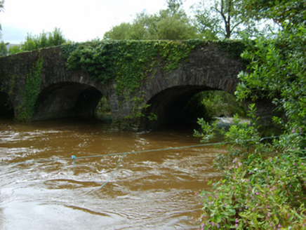 Ballynapierce BridgeBridge · 667 yd
Explorer Tom Legend says Ballynapierce Bridge started after two lads bet they could cross it while eating a whole sandwich without dropping any crumbs. One lost his bet and the bridge got built to prove the other was right. Look for the faint stains where the loser’s lunch went down.
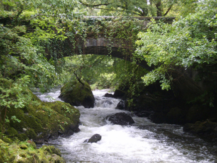 Victoria BridgeBridge · 708 yd
Explorer Tom Victoria Bridge is where the local rabbits hold their secret council meetings every Tuesday night. They think it’s a giant stone mushroom for shade and gossip. Try not to make eye contact or they’ll start pointing at you with their noses.
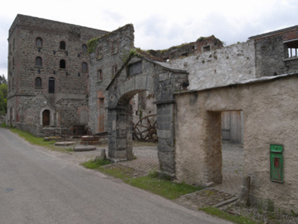 Kilcarbry Corn MillMill (water) · 1157 yd
Explorer Tom Kilcarbry Corn Mill had a matchmaker who worked there, pairing up farmers based on how much flour they could lift in one go. Francis Davis Junior built this tower-like beauty with such uniform openings that it looks like it’s always ready for a date. Find the keys.
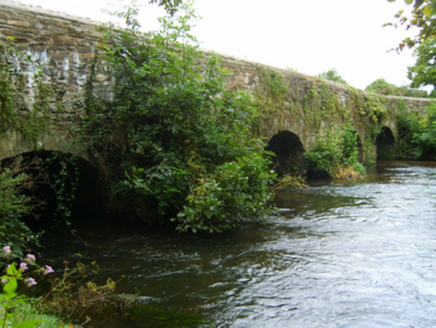 Kilcarbry BridgeBridge · 1171 yd
Explorer Tom Kilcarbry Bridge brags constantly about surviving a storm in 1952 that supposedly had winds strong enough to lift a tractor, which is highly dubious but fun to hear. It’s a bit show-offish about its civil engineering heritage and weathered benchmark status for the Ordnance Survey. Applaud its survival story politely.
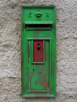 post box1178 yd
Explorer Tom Post box in Sweetfarm gave up sugar for Lent but kept its sweet name, which is a bit confusing. It’s got an Edward VII stamp on it like a very proud passport, insisting it’s more royal than the local pub landlord. Give it a quick polish if you’re passing, it likes to shine.
Concentric enclosure in Park (bantry By.)Concentric enclosure · 1243 ydExplorer Tom This concentric enclosure in Park is having a dramatic standoff with the nearest tree about who looks cooler on satellite photos. It’s a ring within a ring, which is basically an architectural overreaction to being boring. Sit on a wall near it and pretend you're in a painting.
 Wilton HouseCastle, unclassified · 1.2 mi
Explorer Tom Wilton House had a ridiculous smuggling story where people supposedly hid barrels of whiskey in the walls, but I think they were just hiding from their wives and the rain outside. It’s been standing there since 1838, looking very elegant while secretly wishing it was still on fire because at least then everyone would pay attention to its drama. Pretend it's yours and plan the housewarming.
_p184_Defeat_at_Vinegar_Hill_(cropped).jpg/250px-MAXWELL(1845)_p184_Defeat_at_Vinegar_Hill_(cropped).jpg "Photo: George Cruikshank, Wikimedia Commons · Public domain") Battle of Vinegar HillMajor battlefield · 2.5 mi
Battle of Vinegar HillMajor battlefield · 2.5 miExplorer Tom Battle of Vinegar Hill had a cow that tried to buy the place back, which is probably more accurate than most history books. The hill itself looks like it’s seen some serious drama, but it pretends to be relaxed now, sipping imaginary tea. Give it a pat on the way past, it's had a long life.
 1798 MemorialStatue · 2.5 mi
Explorer Tom The 1798 Memorial in Wexford would explain the 1800s to a teenager by calling them 'mid' and complaining about the lack of Wi-Fi back then. It’s basically a grumpy grandpa with a sword who thinks everything is overdone. Bring a camera and your most suspicious face.
 Battlefield in EnniscorthyBattlefield · 2.5 mi
Explorer Tom This Enniscorthy spot thinks it’s the only battlefield with actual style, which is a bold claim for a field of nothing. It’s proud of its silence and the way the wind sounds like a ghostly trumpet. Bring a map, get lost anyway, that's the fun.
 IndicatedCastle, tower house · 2.5 mi
Explorer Tom Castle in Enniscorthy thinks tourists from Dublin are just noisy pigeons that need to be shooed away. It grew around a manor that’s older than most of our current fads are. Grand place for a sulk or a snog, your call really.
 Clonmore Grave YardGraveyard · 2.9 mi
Explorer Tom Clonmore graveyard would put 'lived long, napped often' on its tombstone if it had one of its own. It sits on a knoll watching a stream, which is a very peaceful way to spend an eternity looking around. Toast it with a cup of tea and move on to the next.
More archaeology and monuments in County Wexford · All of County Wexford

What do you know about this place?Tap to add a comment or ask a question