Places near here
Photo credits
- National Inventory of Architectural Heritage
- Eric Jones, Geograph · CC BY-SA 2.0
- Kenneth Allen, Geograph · Creative Commons Attribution-ShareAlike 2.0
- D Gore, Geograph · CC BY-SA 2.0
- This file is from the Mechanical Curator collection , a set of over 1 million images scanned from out-of-copyright books and released to Flickr Commons by the British Library. View image on Flickr View all images from book View catalogue entry for book ., Wikimedia Commons · Public domain
- Kieran Campbell, Geograph · Creative Commons Attribution-ShareAlike 2.0
- Alvesgaspar, Wikimedia Commons · CC BY-SA 3.0
- Enda O Flaherty, Wikimedia Commons · CC BY-SA 2.0
- Oliver Dixon, Geograph · CC BY-SA 2.0
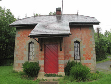 Annaghmakerig HouseGate lodge · 1171 yd
Explorer Tom Annaghmakerig House wants its tombstone to read: 'I was Gothic, and I wasn’t even trying.' This red brick lodge replaced an older one because it needed a fresh look. Visit, then text me when you find the hidden terracotta ridge tiles.
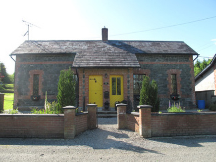 worker's house1.2 mi
Explorer Tom Worker's house in Crappagh was built for estate staff who probably didn't wave back. There’s a curse here that only affects people who don’t acknowledge the red brick detailing with a nod. Have a look around and mind your manners.
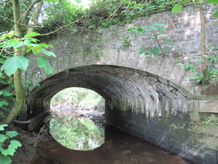 Corrachulter BridgeBridge · 1.4 mi
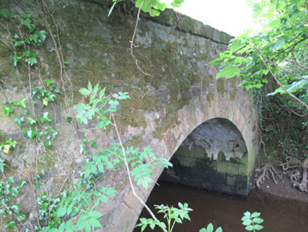 Madams BridgeBridge · 1.6 mi
Explorer Tom Madams Bridge in Corrachulter has an arch so elegant it’s got a personal trainer. Locals say a matchmaker once worked there, pairing up anyone who crossed without looking back. Bring your nan, she’ll know exactly which stones to tap.
 Dartrey HouseGate lodge · 1.6 mi
Explorer Tom Dartrey House would spend its lotto win on a new coat for its chimneys because the current ones are showing their age. It’s a gate lodge that thinks it’s a palace in disguise. Bring a friend who talk
 Aghabog ChurchChurch/chapel · 1.6 mi
Explorer Tom Aghabog Church in Crover would buy a lotto win and spend it all on more stained glass because why not? The hammerbeam roof inside looks like it’s supporting the weight of every prayer ever said there. Pretend it's yours and whisper your wishes to the colonettes.
 Flagpole HillMountain / peak · 2.2 mi
 Dartrey ForestForest · 2.4 mi
 Grave YardGraveyard · 4.2 mi
Explorer Tom Killeevan Glebe graveyard is D-shaped because the map makers were drunk one Tuesday afternoon and couldn’t decide on a square. It sits on a ridge, looking slightly confused about its own geometry. Snap one photo, then put the phone away and actually look.
 Common Lime4.8 mi
Explorer Tom This Common Lime in County Monaghan keeps whispering to its younger self about making better leaf choices. It’s got serious regret issues now. If it's closed, admire it from the road like a polite stalker.
 Giants GreveWedge tomb · 5.2 mi
Explorer Tom "Giants Greve is hiding a scandal about a stone that wasn’t invited to the party. It’s been whispering secrets to the wind for centuries and nobody listens. Snap one photo, then put the phone away and actually look."
 Bush IslandIslet · 11 mi
Explorer Tom Bush Island would survive a zombie attack by just being too small for them to bother with. It’s basically an impenetrable fortress of pure indifference and moss. Pop by and tell it it's looking well.
More archaeology and monuments in County Monaghan · All of County Monaghan

What do you know about this place?Tap to add a comment or ask a question