
Places near here
Photo credits
- National Inventory of Architectural Heritage
- Jean-Pol GRANDMONT, Wikimedia Commons · CC BY 3.0
- Vicente Fernández Rioja, Wikimedia Commons · CC BY-SA 4.0
- Reading Tom, Wikimedia Commons · CC BY 2.0
Explorer Tom Sweathouse in Cavan, County Leitrim was thought to be a lime kiln until someone got curious. A hare dug it up once, which felt very personal. Hang around long enough and you'll hear a story from a local.
Enclosure in DrumhanyEnclosure · 1330 yd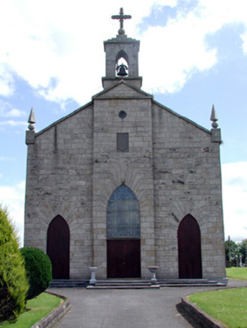 Catholic Church of the Immaculate ConceptionChurch/chapel · 2.3 mi
Explorer Tom Catholic Church of the Immaculate Conception sits on high ground where it can see everything, including your bad parking job, and was built in 1839 with stone from a local quarry. It would post: 'I'm watching you.' Tell the kids it's a castle made by saints.
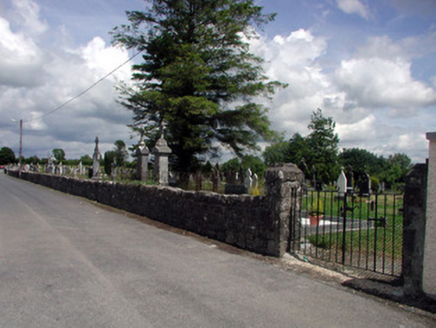 graveyard/cemetery2.4 miTom Dunphy MemorialMemorial · 2.6 miTurlough O'Carolan MonumentHeritage attraction · 2.7 miDeclaration of IndependenceMemorial · 3.2 mi
 Tuliptree4.2 mi
Explorer Tom Tuliptree in County Leitrim is getting picked on by the wind because its leaves look like tiny tulips dancing around. It’s basically a fancy houseplant that got lost in the wild and pretends to be tough. Pack a picnic and an excuse.
 Monkey-puzzle4.2 mi
Explorer Tom Monkey-puzzle in County Leitrim has a grudge against the weather for making it look like a prickly hedgehog. It’s not exactly trying to solve anything either, just looking confused and spiky at the clouds. Bring wellies and low expectations, leave delighted.
Little IslandIslet · 4.3 miCastleCastle, tower house · 4.3 miExplorer Tom Castle in Rinn was designed by a mother-in-law with zero chill and plenty of stone. Fourteen men died there in 1473, which really sets the tone for family dinners. Stand where the owner stood and practise looking smug.
 Cavan & Leitrim RailwayMuseum · 5.0 mi
More archaeology and monuments in County Leitrim · All of County Leitrim

What do you know about this place?Tap to add a comment or ask a question