
What is recorded here
The site of the parish church of Drumcondra (ME006-012001-) is within a rectangular graveyard (dims c. 68m NW-SE; c. 40m N-S; at E to c. 56m NNE-SSW at W) defined by masonry walls. The present Church of Ireland church of St. Peter was built within the graveyard in 1766 (Lewis 1837, vol. 1, 514). The graveyard has a…
Read the whole record
From the National Monuments Service (Archaeological Survey of Ireland) record ME006-012004
Places near here
Picture notes
- Computer-made picture. It does not show this monument.
- Kieran Campbell, Geograph · Creative Commons Attribution-ShareAlike 2.0
- National Inventory of Architectural Heritage
- Rainer Lippert, Wikimedia Commons · CC0
- Computer-made picture. It does not show this playground.
- Nuala Furley, Wikimedia Commons · CC BY-SA 4.0
- Eric Jones, Geograph · CC BY-SA 2.0
- Olivier BEZES, Wikimedia Commons · CC BY 2.5
- Computer-made picture. It does not show this mountain top.
 Not indicatedCross-slab · 12 ydComputer-made picture
Explorer Tom Cross-slab in Drumcondra is playing hard to get, hidden behind a church wall like it’s shy. Locals claim it was nearly sold off as a horse, which I find hilarious. Bring your own legend, I've run out.
 Saint Peter's Church (Drumcondra)Church/chapel · 17 yd
Explorer Tom Saint Peter's Church (Drumcondra) in Rathtrasna would probably have 'Finally Got The Door Right' on its tombstone. That Gibbs surround is doing all the heavy lifting while the rest naps. Toast it with a cup of tea from afar.
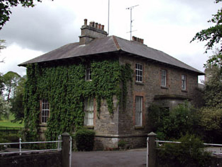 The GlebeRectory/glebe/vicarage/curate's house · 67 yd
Explorer Tom The Glebe in Drumcondra would probably win the lotto and buy a very big hat. It’s got those lovely timber windows that look like they’re winking at you. Ring your granny and tell her it’s still standing firm.
 DrumcondraSettlement deserted, medieval · 92 ydComputer-made pictureMoatCastle, motte · 234 yd
Explorer Tom Moat in Drumcondra is the other one, right next door, which is frankly embarrassing for both of them. The bishop refused to visit because he couldn't find the parking. Mind the nettles, they're the real guards here.
Drumran HillMountain / peak · 1546 yd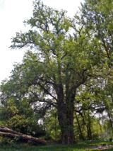 European White Elm4.4 mi
Explorer Tom European White Elm in County Louth claims a fake royal visit that nobody can disprove, complete with a lost crown nobody found. Sit on a wall near it and pretend you're in a painting of its imaginary majesty.
 Children's playground4.6 miComputer-made picture
 Sir Frederick Foster MemorialMemorial · 4.7 mi
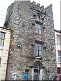 CastleCastle, tower house · 4.7 mi
Explorer Tom Hatch's Castle in Townparks makes a creaking sound at night that sounds like sneezing. It is thoroughly modernised but still thinks it’s spooky. If it's closed, admire it from the road like a polite stalker.
 Lebanon Cedar4.8 mi
Explorer Tom Lebanon Cedar in County Louth was saved by a hero nobody remembers who threw a sandwich at a lightning bolt. Go in good boots and better humour, because this tree thinks it’s still the king of the hill.
 RaffinMountain / peak · 5.9 miComputer-made picture
More archaeology and monuments in County Meath · All of County Meath

What do you know about this place?Tap to add a comment or ask a question