What is recorded here
According to local information there is a possible field system at this location. However, the evidence suggests that the field boundary, which consists of a drystone wall, approximately 3 courses high, post dates the 1st (1839) ed. OS 6-inch sheet. The wall appears to be that which is clearly visible on digitalglobe (viewed 15 August 2016), running ENE-WSW for approximately 100m. It forms the S boundary of a field which is indicated on the 2nd (1905) ed. 6-inch OS map. This field and the field immediately to the E and S have become neglected and are heavily overgrown with gorse/scrub. This rough terrain is also visible on the photograph taken in 1995. This wall is not indicated on the 1st (1839) ed. 6-inch OS map.
According to local information there is a possible field system at this location. However, the evidence suggests that the field boundary, which consists of a drystone wall, approximately 3 courses high, post dates the 1st (1839) ed. OS 6-inch sheet. The wall appears to be that which is clearly visible on digitalglobe (viewed 15 August 2016), running ENE-WSW for approximately 100m. It forms the S boundary of a…
From the National Monuments Service (Archaeological Survey of Ireland) record CW026-032
The monument record does not grant public access. Check the route and ask the landowner before entering private land.
- What survives
- Recorded monument
Places near here
Photo credits
- kevin higgins, Wikimedia Commons · CC BY-SA 2.0
- Donald Hobern from Copenhagen, Denmark, Wikimedia Commons · CC BY 2.0
- Smirkybec, Wikimedia Commons · CC BY-SA 4.0
- A.-K. D., Wikimedia Commons · CC BY-SA 4.0
- Humphrey Bolton, Geograph · Creative Commons Attribution-ShareAlike 2.0
- Sarah777, Wikimedia Commons · CC BY-SA 3.0
- Lisamoriarty1, Wikimedia Commons · CC BY-SA 4.0
- Darrin Antrobus, Wikimedia Commons · CC BY-SA 2.0
- Mike Searle, Wikimedia Commons · CC BY-SA 2.0
- Sarah777, Wikimedia Commons · Public domain
- kevin higgins, Geograph · CC BY-SA 2.0
 Saint Moling's Catholic ChurchChurch/chapel · 1.4 mi
 Silver Wattle1.8 mi
 Church in St. Mullin'sChurch · 2.0 mi
 St. Mullins WellHoly well · 2.0 mi
 Graveyard in St. Mullin'sGraveyard · 2.0 mi
 St. MullinsHistoric town · 2.0 mi
 St. Mullins MoatCastle, motte and bailey · 2.0 mi
 1798 RebellionMemorial · 2.2 mi
 The SpoutSpring · 2.6 mi
 Coolhill Castle (in ruins)Castle, tower house · 2.7 mi
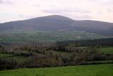 Brandon HillMountain / peak · 4.2 mi
 Freney's WellSpring · 4.5 mi
More archaeology and monuments in County Carlow · All of County Carlow
What do you know about this place?