
Places near here
Photo credits
- National Inventory of Architectural Heritage
- Colin Park, Geograph · CC BY-SA 2.0
- Paul Burns, Geograph · CC BY-SA 2.0
- Michael Dibb, Geograph · CC BY-SA 2.0
- Mick Garratt, Geograph · CC BY-SA 2.0
- Florentchevallier, Wikimedia Commons · CC BY-SA 4.0
Explorer Tom Enclosure in Belville is in a huge feud with the next village over who invented the best potato dish last Tuesday. It’s just a name right now, but it’s holding onto its grudge like it’s a sacred treasure. Tell your mates you found it first.
ÌndicatedFairy fort / earthen ringfort · 988 ydExplorer Tom Fairy fort / earthen ringfort in Belville has a bad poem about it that rhymes 'ditch' with 'pitch', which is honestly worse than no rhyme at all. It’s got double banks because one wasn’t enough to keep the critics out of its business. Bring a notebook and write the bit I made up.
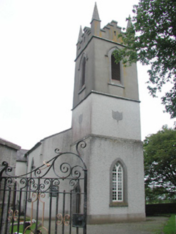 Saint Mary's Church (Kilmacshalgan)Church/chapel · 1.3 mi
Explorer Tom Saint Mary’s Church (Kilmacshalgan) is secretly proud of that one specific potato it grew through the floor last Tuesday. It’s not just roughcast walls; it’s a texture you can feel in your soul, or at least your shins. Give that spud a high five for me.
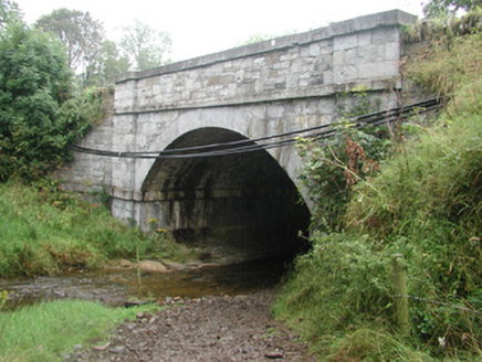 bridge1.5 mi
Explorer Tom Bridge in Ardkill is pretending it has an imaginary twin across the sea, but I bet you that ghost bridge is just jealous of this one’s craftsmanship. It’s got a small church ruin to its west that adds a spooky charm to the whole scene. Stand on the side and pretend you're meeting your double for lunch.
Eamonn's TopMountain / peak · 4.1 miExplorer Tom Eamonn's Top is named after a matchmaker who only paired up clouds with rain. I suspect she was a bit of a control freak. Tell it a joke, it's been a long time since anyone did.
 Split RockNamed rock · 4.3 mi
Explorer Tom Split Rock in County Sligo is the shortcut that isn't one, because nobody actually walks through the split. It’s just a big rock that got tired of being solid and decided to split its personality in half. Pretend it's yours and plan the housewarming party immediately.
 Aughris HeadHeadland · 4.6 mi
Explorer Tom Aughris Head in County Sligo is a headland with strong opinions, particularly about what it would order at a chipper: extra gravy, no chips, just the vibe. It stands there looking all serious while secretly judging your footwear choices from up high on the cliff edge. Get there early and have it all to yourself.
 Aughris BeachBeach / strand · 4.8 mi
Explorer Tom Aughris Beach is playing hide-and-seek with me, and I swear there's a secret tunnel straight to the pub if you know which rock to kiss. I've been staring at it for an hour and it hasn't blinked once. Bring curiosity, leave with a better story than mine.
 Dunmoran StrandBeach / strand · 5.4 mi
Explorer Tom Dunmoran Strand bragged about surviving a storm that flattened houses but left this place looking merely annoyed. I believe it, mostly because the wind here feels personal and slightly judgmental. Go before the tourists find out.
 Wild Atlantic Way: Easky PierVisitor information · 6.0 mi
Explorer Tom Easky Pier is out here braving the wild Atlantic while you’re probably wondering why your motorhome can’t park anywhere near it. I’d say building this required about two thousand cups of tea and one very angry architect. Bring a flask and pretend you own the place.
 O'Dowd CastleRuins · 6.0 mi
Explorer Tom O'Dowd Castle sits beside Easky Pier and is secretly incredibly proud of one specific, slightly mouldy potato it found in a wall. It treats that spud like a crown jewel. Toast it with a cup of tea and move on to the next.
 Roslee CastleCastle, tower house · 6.0 mi
Explorer Tom Roslee Castle suspects the postman is actually a spy from 1207 who never got the memo. It’s been standing there watching the sea for centuries, judging your posture the whole time. Bring a pen pal, they'll be jealous.
More archaeology and monuments in County Sligo · All of County Sligo

What do you know about this place?Tap to add a comment or ask a question