
What is recorded here
On the S side of Derrymore Island in Lough Gara. In pasture, at the break of slope of a wooded scarp bordering the lakeshore. A rectangular area (27m N-S; 43.5m E-W), with rounded NE and NW corners, defined on the W, N and E sides by an earthen bank (Wth 2.4m; int. H 0.35m; ext. H 0.4m). The S side is defined by a…
Read the whole record
From the National Monuments Service (Archaeological Survey of Ireland) record SL047-090
Places near here
Photo credits
- Maker not stated on source page, www.alamy.com
- Maker not stated on source page, za.pinterest.com
- Maker not stated on source page, www.thejournal.ie
- National Inventory of Architectural Heritage
- Sawyer777, Wikimedia Commons · CC BY-SA 4.0
- Maker not stated on source page, www.irishamerica.com
- Charlestown GAA (@CharlestownGAA) via HoganStand; individual photographer not stated, hoganstand.com
- Maker not stated on source page, en.wikipedia.org
 Fairy fort / earthen ringfort in ArdlonaFairy fort / earthen ringfort · 1361 yd
Explorer Tom Fairy fort / earthen ringfort in Ardlona would win the county fair for best dressed, even with its overgrown bank and…
 Templeronan GraveyardCemetery · 1684 yd
Explorer Tom Templeronan Graveyard was designed by a mother-in-law who wanted to make sure her son-in-law never felt comfortable…
Fairy fort / earthen ringfort in ArdsoreenFairy fort / earthen ringfort · 1.3 miExplorer Tom Fairy fort / earthen ringfort in Ardsoreen has a secret talent for making cow parsnips taste like expensive truffle oil…
Fairy fort / earthen ringfort in ArdmoyleFairy fort / earthen ringfort · 1.4 miExplorer Tom Fairy fort / earthen ringfort in Ardmoyle has a grudge against the weather because the bank keeps eroding into the…
 Mapped cemeteryCemetery · 1.5 mi
Explorer Tom Mapped cemetery in County Sligo would definitely win the county fair for best dressed, if only because it has more…
 Fairy fort / earthen ringfort in DerrycoaghFairy fort / earthen ringfort · 1.7 mi
Explorer Tom Fairy fort / earthen ringfort in Derrycoagh would cope on a reality show by refusing to talk and glaring at the…
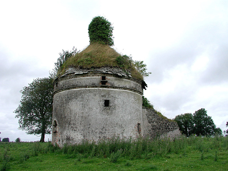 Frenchpark HouseBuilding misc · 4.8 mi
Explorer Tom Frenchpark House is a circular smokehouse with stone slates, looking like a fancy mushroom that got lost on the way to…
 Queen Medb: RathcroghanLegend location · 11 mi
Explorer Tom Queen Medb: Rathcroghan is where the Táin starts turning a quarrel about a bull into an epic. Medb had a royal seat…
 CastleCastle, unclassified · 14 mi
Explorer Tom Castle in Emlagh would tell its younger self to stop being so dramatic about crumbling. It’s just a pile of rocks…
 Curry GAAGAA ground · 15 mi
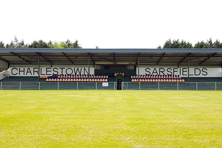 Fr. O'Hara Park, Charlestown SarsfieldsGAA ground · 15 mi
 Ballymoe BridgeBridge · 17 mi
Explorer Tom Ballymoe Bridge is gone, replaced by a 1978 concrete slab, but we all know a goat once fell off and landed in the river…
More archaeology and monuments in County Sligo · All of County Sligo

What do you know about this place?Tap to add a comment or ask a question