
What is recorded here
From the National Monuments Service (Archaeological Survey of Ireland) record MA115-004
Places near here
Photo credits
- Colin Park, Geograph · CC BY-SA 2.0
- Newbert12, Wikimedia Commons · CC BY-SA 4.0
- Maker not stated on source page, www.pinterest.com
- Britishfinance, Wikimedia Commons · CC BY-SA 4.0
- Maker not stated on source page, commons.wikimedia.org
- Didier Descouens, Wikimedia Commons · CC BY-SA 4.0
- National Inventory of Architectural Heritage
- Alan Reid, Geograph · CC BY-SA 2.0
- Gordon Dunn, Wikimedia Commons · CC BY-SA 2.0
- dalvenjah on Flickr, Wikimedia Commons · CC BY-SA 2.0
- Maker not stated on source page, www.irishamericanmom.com
 Mweelrea se SpurMountain / peak · 1586 yd
Explorer Tom Mweelrea SE Spur is the part of the mountain that everyone ignores because they’re too busy looking at the main peak. A…
 Salrock ChurchChurch/chapel · 1.7 mi
Explorer Tom Salrock Church was built on a bargain where the devil traded good lighting for a slightly crooked steeple, which I…
 Tobersalrock Holy well (Site of)Holy well · 1.8 mi
Explorer Tom Tobersalrock Holy well in Foher is how many cups of tea it took to build. It’s gone now, but the church nearby still…
 MweelreaMountain / peak · 1.8 mi
Explorer Tom Mweelrea is Connacht's highest mountain, and it has no interest in pretending that 814 metres is a casual afternoon. It…
 Fairy fort / stone ringfort in Lettergesh EastFairy fort / stone ringfort · 2.2 mi
Explorer Tom Fairy fort / stone ringfort in Lettergesh East is an oval cashel on a small hill, commanding a pass between two loughs.…
 Hawthorn2.2 mi
Explorer Tom Hawthorn in County Galway is why map makers keep getting confused; they draw straight lines but this tree just refuses…
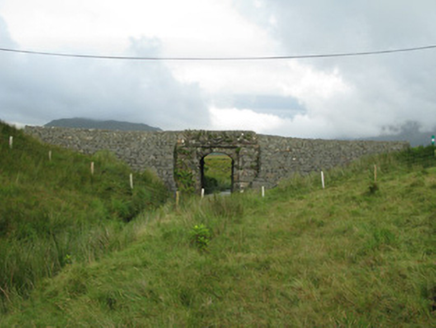 bridge2.3 mi
Explorer Tom Bridge in Derrynacleigh is staring at that river with pure suspicion. I reckon it thinks the postman is smuggling…
 Glassilaun BeachBeach / strand · 3.1 mi
Explorer Tom Glassilaun Beach lies near the mouth of Killary Harbour, where white sand opens towards the water and Mweelrea rises…
 Uggool BeachBeach / strand · 3.3 mi
Explorer Tom Uggool Beach is secretly proud of one specific potato growing in its sand, which I think is hilarious given the…
 Silver StrandBeach / strand · 3.9 mi
Explorer Tom Silver Strand in County Mayo does some very strange things when nobody’s looking, like rearranging its own pebbles into…
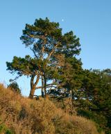 Monterey Pine5.1 mi
Explorer Tom Monterey Pine in County Galway once saw a fox try to climb it but get stuck halfway up because the branches were too…
 The WaterfallVisitor information · 5.3 mi
Explorer Tom The Waterfall is planning to spend its lotto win on a very expensive pair of swim trunks and a vacation to the moon…
More archaeology and monuments in County Mayo · All of County Mayo

What do you know about this place?Tap to add a comment or ask a question