
What is recorded here
In pasture, on a SE-facing slope. The enclosure is visible on an aerial photograph (GSI S. 647/6. 16/04.1974). The remains of an oval area (dims. 50m NW-SE; 60m NE-SW) enclosed by traces of a levelled bank (Wth 4.2m; int. H 0.2m; ext. H 0.2m) best defined NW-E-SSW. In the SE-SSW sector a berm (Wth 4m), the remains of…
Read the whole record
From the National Monuments Service (Archaeological Survey of Ireland) record TS072-007
Places near here
Photo credits
- Maker not stated on source page, tr.pinterest.com
- A.-K. D., Wikimedia Commons · CC BY-SA 4.0
- Maker not stated on source page, www.dreamstime.com
- liam murphy, Geograph · CC BY-SA 2.0
- Maker not stated on source page, www.pinterest.com
- Kmcnamee, Wikimedia Commons · CC BY-SA 4.0
- Maker not stated on source page, commons.wikimedia.org
- National Inventory of Architectural Heritage
- kevin higgins, Geograph · CC BY-SA 2.0
- Willow, Wikimedia Commons · CC BY 2.5
- Steve & Jemma Copley on Flickr, Wikimedia Commons · CC BY-SA 2.0
 Bullaun stone in TemplemichaelBullaun stone · 1085 yd
Explorer Tom The bullaun stone in Templemichael is fixed to a pier right by the gate, acting like a bouncer who never actually…
 Templemichael Grave YardGraveyard · 1088 yd
Explorer Tom Templemichael graveyard has a local who swears he invented the stile before it got blocked off by spiteful masonry.…
 Templemichael GraveyardGraveyard · 1089 yd
Explorer Tom Templemichael Graveyard has had so many names that it gives up trying to choose one. It just goes by whatever sounds…
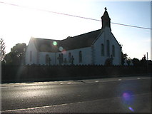 Saint Mary's Catholic ChurchChurch/chapel · 1452 yd
Explorer Tom Saint Mary's Catholic Church in Grangemockler was built in 1805 and still has fine internal features like an ornate…
 CastleCastle, unclassified · 1637 yd
Explorer Tom Castle in Bleenaleen Lower is full of ridiculous smuggling stories about cheese and contraband socks. It’s just a stump…
 Grangemockler / Ballyneale GAA pitchGAA ground · 1.1 mi
 Grange CemeteryCemetery · 1.4 mi
Explorer Tom The second Grange Cemetery has an opinion on the local sheep that they are far too loud for such a peaceful resting…
 Whitehall BridgeBridge · 1.4 mi
Explorer Tom Whitehall Bridge in Brenormore is showing off those fancy arches while the river flows underneath like nothing…
 Oldcastle Castle (site of)Archaeological place · 2.0 mi
Explorer Tom Oldcastle Castle in County Kilkenny has an imaginary twin across the sea that refuses to show up to family reunions…
 SheegounaMountain / peak · 4.3 mi
Explorer Tom Sheegouna’s only New Year's resolution is to stop rolling its 'r' sounds so aggressively at passing sheep, which has…
 European ash4.4 mi
Explorer Tom European ash in County Tipperary knows the shortcut through its branches isn't actually a shortcut at all, but rather a…
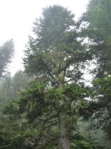 Silver Fir4.5 mi
Explorer Tom Silver Fir in County Tipperary once had a cow try to buy the whole lot with a single hoof stamp on a contract. The tree…
More archaeology and monuments in County Tipperary · All of County Tipperary

What do you know about this place?Tap to add a comment or ask a question