
What is recorded here
On a flat raised platform in gently undulating terrain, surrounded by pasture, with ground sloping to the W beyond the graveyard wall. A road runs N-S along the E side of the graveyard. The remains of a medieval church (TS072-002001-) are located in the NW quadrant of the graveyard. A roughly square graveyard (diam. c. 26m) which is surrounded by a stone wall (H 2m) of sandstone rubble, roughly coursed and capped with concrete. The original entrance in the S wall, E of centre, consists of two stone gate piers, the opening of which is now occupied by stone steps. The earliest noted headstone dates to 1740 and is in the SE quadrant. The headstones are mainly 19th century in date with some 20th century examples. No recent headstones were noted. A bullaun stone (TS072-002003-) has been fixed onto a stone pier at the S end of the E wall of the graveyard adjacent to the present gate access. Four limestone architectural fragments from the church have been re-used as headstones, including a mullion with chamfered edges, two mullions with hollow chamfers and an external rebate, and a chamfered sill/lintel.
On a flat raised platform in gently undulating terrain, surrounded by pasture, with ground sloping to the W beyond the graveyard wall. A road runs N-S along the E side of the graveyard. The remains of a medieval church (TS072-002001-) are located in the NW quadrant of the graveyard. A roughly square graveyard (diam. c. 26m) which is surrounded by a stone wall (H 2m) of sandstone rubble, roughly coursed and capped…
From the National Monuments Service (Archaeological Survey of Ireland) record TS072-002001
The monument record does not grant public access. Check the route and ask the landowner before entering private land.
- What survives
- Recorded monument
Places near here
 Standing stone in BallinvirStanding stone · 660 yd
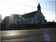 Saint Mary's Catholic ChurchChurch/chapel · 1348 yd
 Whitehall BridgeBridge · 1.0 mi
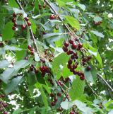 Wild Cherry2.4 mi
 Holy well in Oldcastle LowerHoly well · 2.6 mi
 Knockroe Passage TombVisitor information · 2.7 mi
 Killamery High CrossVisitor information · 2.9 mi
 Bawn in KilcashBawn · 3.6 mi
 Kilcash Castle (in ruins)Castle, tower house · 3.6 mi
 SheegounaMountain / peak · 3.7 mi
 James (Jim) McKennaMemorial · 4.1 mi
 SlievenamonMountain / peak · 4.2 mi
Pictures: A.-K. D., Wikimedia Commons · CC BY-SA 4.0; liam murphy, Geograph · CC BY-SA 2.0; National Inventory of Architectural Heritage; MPF, Wikimedia Commons · CC BY 2.5; kevin higgins, Geograph · CC BY-SA 2.0; Humphrey Bolton, Geograph · CC BY-SA 2.0; A.-K. D., Wikimedia Commons · CC0; Colin Park, Geograph · CC BY-SA 2.0
More archaeology and monuments in County Tipperary · All of County Tipperary
What do you know about this place?