What is recorded here
At the foot of hill which rises immediately to the S, the slope continues to fall gradually northward. In wet terrain in rough pasture. A roughly circular well (1.7m x 1.55m) composed of dry-stone walling (T 0.5m) with an exit channel to the N. The channel (L 3.8m) is stone lined and covered by seven stone lintels. A lot of stones have collapsed into the well. The water in the well is c. 0.2m deep. A local man, who knew of the location of the well though he had never visited it himself, called it 'Tobereennadomhnaigh' and said it was visited on Easter Sunday, though this is no longer practiced. According to Power (1908, 66) the well called 'Tobairin Domhnaigh' or 'Sunday Well' was visited on Sunday and a specific prayer, in Irish, was recited.
At the foot of hill which rises immediately to the S, the slope continues to fall gradually northward. In wet terrain in rough pasture. A roughly circular well (1.7m x 1.55m) composed of dry-stone walling (T 0.5m) with an exit channel to the N. The channel (L 3.8m) is stone lined and covered by seven stone lintels. A lot of stones have collapsed into the well. The water in the well is c. 0.2m deep. A local man,…
From the National Monuments Service (Archaeological Survey of Ireland) record TS086-032
The monument record does not grant public access. Check the route and ask the landowner before entering private land.
- What survives
- Recorded monument
Places near here
Photo credits
- National Inventory of Architectural Heritage
- john salter, Geograph · CC BY-SA 2.0
- Martin Richard Phelan, Wikimedia Commons · CC BY-SA 2.0
- Ivar Leidus, Wikimedia Commons · CC BY-SA 3.0 ee
- A copy of this photograph is owned by National Library of Ireland and can be viewed here [1], Wikimedia Commons · Public domain
- Mike Murphy ( talk · contribs ), Wikimedia Commons · CC BY-SA 3.0
- Mike Searle, Wikimedia Commons · CC BY-SA 2.0
 Glenduff BridgeBridge · 1360 yd
 Ballywilliam HouseHouse · 1439 ydCurraleigh MountainMountain / peak · 1443 ydEnclosure in NewcastleEnclosure · 1.7 miSite of Kiltankin ChurchChurch · 1.8 miRonald Reagan CentreHeritage attraction · 2.1 mi
 Carran HillMountain / peak · 3.1 mi
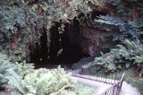 Mitchelstown CaveCave · 3.4 mi
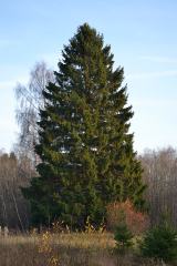 Norway Spruce4.7 mi
 Shanbally CastleCastle · 4.8 mi
 Giant Sequoia4.8 mi
 Burncourt CastleCastle · 5.0 mi
More archaeology and monuments in County Tipperary · All of County Tipperary
What do you know about this place?