DDiscover AloneMapAbout

Linear earthwork in Cupidstown

Linear earthwork
Computer-made picture that does not show Linear earthwork in CupidstownNot a photo of this monument
Computer-made picture. It does not show this monument. · Report the wrong picture

The monument record does not grant public access. Check the route and ask the landowner before entering private land.

What do you know about this place?Tap to add a comment or ask a question

What you write will be public.

What is recorded here

The area which would later be called 'The English Pale', from the Latin 'palus', a stake, and also possibly from the name of an earthen fortification at Calais in France (Lydon 1972, 261), originated in the 14th century when Norman settlers began fortifying their lands in counties Dublin, Kildare, Louth and Meath…

Read the whole record
The area which would later be called 'The English Pale', from the Latin 'palus', a stake, and also possibly from the name of an earthen fortification at Calais in France (Lydon 1972, 261), originated in the 14th century when Norman settlers began fortifying their lands in counties Dublin, Kildare, Louth and Meath against attack by the native Irish. By 1435, ongoing attacks, probably primarily aimed at cattle theft (Ó Ríordáin 1971, 15), prompted the concept of an additional, linear defensive feature, the boundaries of which were defined in a 1488 Act of Parliament as extending, 'from Merrion inclusive to the waters of the Dodder, by the new ditch to Saggard, Rathcoole, Kilheel (Kilteel), Rathmore and Ballymore (Eustace), thence to the county of Kildare into Ballycutlan (Coghlanstown), Harristown and Naas, and so thence to Clane, Kilboyne, and Kilcock' (McNeill 1950, 250). In 1494, Parliament directed that, 'every inhabitant, earth tiller and occupier in said marches (borderlands), do build and make a double ditch six feet high above ground at one side or part which meareth next unto Irishmen between this and next Lammas (August 1st.), the said ditches to be kept up and repaired as long as they shall occupy said land.' However, Ellis (Ellis S. G. 'The emergence of the English Pale in Ireland' in Irish Historical Studies) points to a statute in Poyning's parliament in 1495 for 'ditches to be made aboute the Inglishe pale' as the first application of the term to Ireland. The Pale contracted eastwards in subsequent years and it is not certain if its original extent was ever completely ditched. By the 17th century the Pale had ceased to have any real political or defensive significance. Only a few short sections have been positively identified in Co Kildare; in Kilteel Upper/Cupidstown near Rathmore (KD020-008-----), in Bishopsland just SW of Ballymore Eustace (KD029-039----), at Castlebrown or Clongowes (KD010-021----/KD014-008----) and finally, the best preserved, semi-continuous portion which runs for c. 3365m through the townlands of Ballybrack, Ballyloughan, Clonduff, Clonfert South and Graiguepottle, c. 5km N of Clongowes (KD010-001----). In Kilteel Upper/Cupidstown, a 1966 aerial photograph (CUCAP APA056) shows extensive earthworks around the early monastic foundation of 'Cell céli críst' (KD020-007002-) upon which a preceptory of Knights Hospitallers of St John of Jerusalem (KD020-007003-) was founded in the 13th c. Manning (1981-82, 213, 219) subsequently identified some of the earthworks which ran to the S and W of the preceptory as being part of the Pale Boundary (traceable L c. 1100m). The main line of the earthwork, to the S of the ecclesiastical remains, was a shallow ditch (Wth 3.5m; D 0.6m) with a broad, low earthen bank (Wth 6.5m; H 0.6m) 'outside', to S, and a low, earthen, bastion-like projection was also noted. A small, overgrown section of the earthwork c. 750m E of the ecclesiastical remains was subsequently excavated archaeologically as it lay on the line of the Cork-Dublin Gas-pipeline (O'Donnell 1987, 110; Cleary et al. 1987, 106-110). An earthen bank (H 1.27m; Wth 2m) had a shallow, 'outer' ditch (Wth 2.26m; D 0.23m) to SW, while second 'inner' ditch to NE had been recently recut. A palisade-trench (D 0.38m; Wth at top 0.34m; Wth at base 0.24m) was found running along the top of the bank. See attached Google Earth aerial photos taken 04/05/2019 and 02/04/2013 showing pale ditch to S of Kilteel church and graveyard Compiled by: Gearóid Conroy Date of upload: 10 June 2011

From the National Monuments Service (Archaeological Survey of Ireland) record KD020-008

Places near here

Photo credits
  • Maker not stated on source page, readymap.irish
  • Bogman, Wikimedia Commons · CC BY-SA 3.0
  • Maker not stated on source page, commons.wikimedia.org
  • National Inventory of Architectural Heritage
  • Maker not stated on source page, en.wikipedia.org
  • Colin Park, Geograph · CC BY-SA 2.0
  • Maker not stated on source page, nexusnewsfeed.com
  • Guinevere's Garden; photographer not stated, Guinevere's Garden
  • Maker not stated on source page, www.irishmirror.ie
Kilteel GraveyardGraveyard · 253 yd

Explorer Tom Kilteel Graveyard’s name actually means "The Hill Where We Forgot To Put Fences," according to my very reliable uncle.…

Church (in Ruins)Church · 259 yd

Explorer Tom Church in Kilteel Upper would complain to the council that the grass is too long and the tourists are too loud. It’s…

Cross-inscribed stone (present location) in Kilteel UpperCross-inscribed stone (present location) · 259 yd

Explorer Tom Cross-inscribed stone in Kilteel Upper is buried in a church wall, looking like it wants a quiet retirement. It…
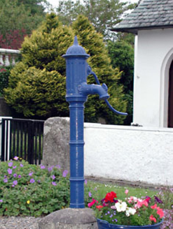
water pump421 yd

Explorer Tom Water pump in Kilteel Lower claims to be older than the hills themselves if you believe its marketing team. It's…
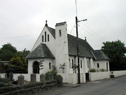
Catholic Church of Saint Laurence O'TooleChurch/chapel · 427 yd

Explorer Tom Catholic Church of Saint Laurence O'Toole has been in a bitter feud with the rain since 1935. The designer wanted…

Kilteel CastleCastle, tower house · 479 yd

Explorer Tom Kilteel Castle was guarded by Knights Hospitallers who probably spent all night playing fiddle tunes that drove the…

Earthwork in Kilteel LowerEarthwork · 517 yd

Explorer Tom Earthwork in Kilteel Lower gets picked on by the wind because it’s too quiet. It’s a broad bank that refuses to show…

Cupidstown HillMountain / peak · 1.1 mi

Explorer Tom Cupidstown Hill is claimed by a local who says he invented it while walking his dog, which is bold but I respect the…

Fairy fort / ringfort in BadgerhillFairy fort / ringfort · 1.4 mi

Explorer Tom Fairy fort / ringfort in Badgerhill is on a hill but not visible at ground level, so its first owner probably had an…
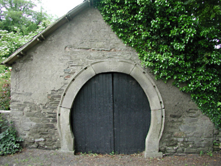
forge/smithy1.5 mi

Explorer Tom Forge or smithy in Calliaghstown Lower is a rare survivor with an inscribed stone arch that screams history. The…

June Blake's GardenGarden · 1.9 mi

Explorer Tom June Blake's Garden at Tinode began with a sheep paddock and grew into three acres that seem to have quietly outwitted…

Mapped cemeteryCemetery · 2.3 mi

Explorer Tom Mapped cemetery in County Dublin is sick of being asked if it’s haunted, because yes, obviously, but that’s not the…

More archaeology and monuments in County Kildare · All of County Kildare

Add to this placeAdd a picture Add a detailed tip Add a story

Explore the map1,095,414 places to discover

Next place · or swipeKilteel Graveyard