What is recorded here
Located at the base of a steep S-facing slope of the NW-SE ridge of Cairnglass Hill, at a point where a N-S spur extends off to the SW of the site and also where a less severe SE-facing slope leads down to the N-S Blackwater River, which is c. 800m to the E. This is a subcircular scrub-covered area (dims. 36m N-S; 31m…
Read the whole record
Located at the base of a steep S-facing slope of the NW-SE ridge of Cairnglass Hill, at a point where a N-S spur extends off to the SW of the site and also where a less severe SE-facing slope leads down to the N-S Blackwater River, which is c. 800m to the E. This is a subcircular scrub-covered area (dims. 36m N-S; 31m E-W) defined by an earthen bank (Wth 3.5-5m; int. H 0.2m at S (downslope) to 1.5m at N; ext. H 0.5-1.5m) which is reduced to an external scarp (H 3m) at S, with external stone-facing SW-NE and internal stone-facing SSE-SSW. There is no visible fosse, and the entrance (Wth 2.4m) at SE is now blocked. A Man-made underground passage (WA034-020002-) is S of the centre. Revised by: Michael Moore
Date of upload: 27 September 2011
From the National Monuments Service (Archaeological Survey of Ireland) record WA034-020001
Places near here
Photo credits
- National Inventory of Architectural Heritage
- MonikaLisa2, Wikimedia Commons · CC BY-SA 4.0
- Mike Searle, Geograph · CC BY-SA 2.0
- Willow, Wikimedia Commons · CC BY 2.5
- Hywel Williams, Wikimedia Commons · CC BY-SA 2.0
- Gfwc70, Wikimedia Commons · CC BY-SA 4.0
- dougf, Geograph · CC BY-SA 2.0
- Hywel Williams, Geograph · Creative Commons Attribution-ShareAlike 2.0
 outbuilding1.5 mi
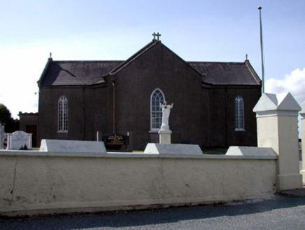 Catholic Church of the Sacred HeartChurch/chapel · 1.7 mi
 Dromore WoodWood · 2.4 mi
 Clashmore Heritage CentreHeritage attraction · 2.6 mi
 Molana AbbeyHeritage attraction · 2.6 mi
 European ash2.6 mi
 Ogham StonesOgham stone · 2.9 mi
 Site of ChurchChurch · 2.9 mi
 Templemichael Castle (in ruins)Castle, tower house · 2.9 miCastle (in ruins)Castle, tower house · 3.0 miSt Bridget's WellSpring · 3.3 mi
 Saint Declan's Holy WellSpring · 3.9 mi
More archaeology and monuments in County Waterford · All of County Waterford
What do you know about this place?Tap to add a comment or ask a question