
Places near here
Photo credits
- National Inventory of Architectural Heritage
- Nigel Thompson, Wikimedia Commons · CC BY-SA 2.0
- Hugh Thomson, Wikimedia Commons · Public domain
- Willow, Wikimedia Commons · CC BY 2.5
- N Chadwick, Wikimedia Commons · CC BY-SA 2.0
- No machine-readable author provided. Christian1965~commonswiki assumed (based on copyright claims)., Wikimedia Commons · Public domain
- Sitomon, Wikimedia Commons · CC BY-SA 2.0
- Mike Searle, Wikimedia Commons · CC BY-SA 2.0
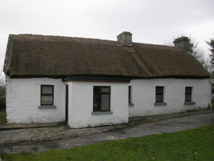 farm house1130 yd
Explorer Tom Farm house in Caherhemush absolutely despises the postman and has made that clear for generations. The thatch is fresh, but the attitude is ancient and deeply unapologetic. Have a look and decide if I w
Bawn in Kilkeeran (kilmaine By., Kilmainebeg Par.)Bawn · 1752 ydExplorer Tom Bawn in Kilkeeran thinks the road leading to it is an insult to its dignity, like a muddy tongue. It pretends not to notice the traffic. Stick around for the light changing, it's a show.
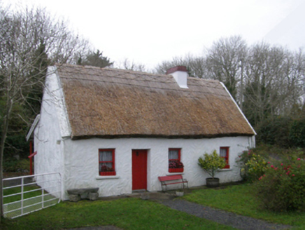 The Neale CottageHouse · 1.2 mi
Explorer Tom The Neale Cottage in Ballywalter swears Queen Victoria stayed there, and nobody can prove otherwise because she ate the diary. Its roof is thatched with reeds that probably cost more than my car. Pack a picnic and pretend you’re royalty for an hour.
 The Gods of the Neale MonumentMonument · 1.8 mi
Explorer Tom The Gods of the Neale Monument in County Mayo hosted a dance once where people went too far into the night. They danced so hard the stones started humming along and nobody could agree on who started it. Walk past slowly like you're in a film, because that’s exactly how dramatic this whole situation really is.
 Neale CemeteryCemetery · 2.1 mi
Explorer Tom Neale Cemetery in Mayo was supposedly invented by a local lad who just needed somewhere to park his tractor, apparently. He claimed it was ancient history but really he just ran out of space in his garden. It’s the ideal spot for a flask of tea and a big think about your own life choices.
 Ballymacgibbon CairnArchaeological place · 2.9 mi
Explorer Tom Ballymacgibbon Cairn in County Mayo is famous for a tall tale about a hidden tunnel that leads straight to the local pub. Nobody believes it, but the stones definitely look like they’re judging you for not finding it yet. Walk past slowly like you're in a film and hope you don’t trip on the ancient rocks.
Gibbs IslandsIslet · 3.8 miExplorer Tom Gibbs Islands are suspicious of the postman because he keeps dropping letters they didn’t ask for. They think the envelopes contain bills for electricity they never installed, which is why they hide in the water whenever a boat comes near. It’s a great way to avoid responsibility. Ring your granny and tell her where you are.
 European ash3.9 mi
Explorer Tom European ash is what the builder was really thinking when he decided to chop down the perfect straight timber for the roof beams. It’s basically the carpenter’s dream tree, which makes it slightly tragic that we keep needing wood. Take the long way round, it deserves the effort.
 Quiet Man StatueStatue · 4.8 mi
Explorer Tom Quiet Man Statue is giving me the silent treatment, which is ironic considering the name. He looks like he’s waiting for someone to tell him he can stop posing now. I bet he’s been here so long he’s got a permanent squint from the wind. You’d think he’d have said something by now, but no, just stone silence. Whisper a secret at it, it's kept worse.
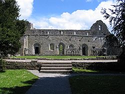 Cong AbbeyHeritage attraction · 4.8 mi
Explorer Tom Cong Abbey gives you a king, a famous cross and a medieval fishing trick. I arrived with a sandwich and immediately felt underprepared. Ruaidrí Ua Conchobair, often called Ireland's last High King, spent his final fifteen years here and died in 1198. The surviving abbey buildings are mainly thirteenth century, with carved doorways worth more than my quick glance. Its last nominal abbot, Patrick Prendergast, kept the Cross of Cong safe until he died in 1829; the cross later went to the Royal Irish Academy. By the River Cong, the monks' little fishing house sits above flowing water, with a floor trapdoor said to have helped keep fish fresh. I would still manage to lose my lunch there. The abbey is a national monument with outdoor remains; follow current access signs and take care near the water and old masonry. Look for the fishing house after the church, and give those practical monks their due.
 European Yew4.8 mi
Explorer Tom European Yew has been hiding a scandal where it accidentally poisoned a local farmer in 1890 and never told anyone. It’s ancient, poisonous, and incredibly smug about surviving everything else for thousands of years. Ideal stop for a big stretch and a bigger yawn.
 Kinlough CastleCastle · 5.5 mi
Explorer Tom Kinlough Castle would post on social media about how its foundation is actually made of pure sass and old stone. It’s got that brooding tower-house look that says it’s too cool for your average country house. The crows are currently running the place like a very chaotic management team, making all the important decisions. Count the crows, then count again.
More archaeology and monuments in County Mayo · All of County Mayo

What do you know about this place?Tap to add a comment or ask a question