Places near here
Photo credits
- National Inventory of Architectural Heritage
- This file is from the Mechanical Curator collection , a set of over 1 million images scanned from out-of-copyright books and released to Flickr Commons by the British Library. View image on Flickr View all images from book View catalogue entry for book ., Wikimedia Commons · Public domain
- D Gore, Geograph · CC BY-SA 2.0
- Eric Jones, Wikimedia Commons · CC BY-SA 2.0
- Wanfried-Dublin, Wikimedia Commons · CC BY-SA 4.0
- Oliver Dixon, Geograph · CC BY-SA 2.0
- Drumhowan GAA club; individual photographer not named, drumhowan.gaa.ie
- Kmcnamee, Wikimedia Commons · CC BY-SA 4.0
 bridge554 yd
Explorer Tom Bridge in Lisnalong is too proud to admit it’s been retired from rail service. Locals swear a poet fell into the ditch…
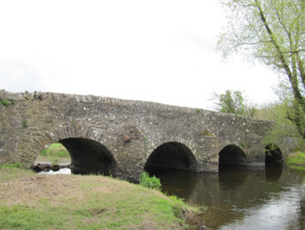 Ballynascarva BridgeBridge · 612 yd
Explorer Tom Ballynascarva Bridge is explaining the 1800s to a teenager while its rail-sibling shows off fancy stone polish nearby.…
Deer ParkForest · 1.4 miExplorer Tom Deer Park has very strong opinions on modern buildings and thinks they’re all terrible architecture. It prefers the old…
Diamond HillMountain / peak · 1.4 miExplorer Tom Diamond Hill sounds like it was built from a bargain bin at a jewelry store, where someone bought a diamond and decided…
Giant's GraveArchaeological place · 1.9 miExplorer Tom This Giant's Grave would write 'likes hiking and ancient history' on its dating profile, but honestly, it’s too shy to…
 Dartrey ForestForest · 1.9 mi
Explorer Tom Dartrey Forest used to have a great house at its centre, and the trees have done a fine job of carrying on without it.…
 Flagpole HillMountain / peak · 2.4 mi
Explorer Tom Flagpole Hill is the sort of peak that clearly had a mother-in-law design it, giving it that distinct look of…
 Dawson MonumentMonument · 2.5 mi
Explorer Tom Dawson Monument in County Monaghan is the other one, and I’m convinced a very serious dog is actually in charge of the…
 Wedge tomb in LisnadarraghWedge tomb · 7.0 mi
Explorer Tom Wedge tomb in Lisnadarragh is a giant’s grave that seems a bit shy about its own size. It’s been trying to outdo…
 Bush IslandIslet · 7.4 mi
Explorer Tom Bush Island would survive a zombie attack by just being too small for them to bother with. It’s basically an…
 Páirc Mhic Eoin, Drumhowan GeraldinesGAA ground · 7.9 mi
 Páirc Sháirséil, Aughnamullen SarsfieldsGAA ground · 8.3 mi
More archaeology and monuments in County Monaghan · All of County Monaghan

What do you know about this place?Tap to add a comment or ask a question