Places near here
Photo credits
- National Inventory of Architectural Heritage
- Kenneth Allen, Geograph · Creative Commons Attribution-ShareAlike 2.0
- Allie_Caulfield from Germany, Wikimedia Commons · CC BY 2.0
- abdallahh from Montréal, Canada, Wikimedia Commons · CC BY 2.0
- Andreas F. Borchert, Wikimedia Commons · CC BY-SA 3.0 de
- Kenneth Allen, Wikimedia Commons · CC BY-SA 2.0
- Raymond Okonski, Wikimedia Commons · CC BY-SA 2.0
- Brian Lenehan, Geograph · CC BY-SA 2.0
- Enda O Flaherty, Wikimedia Commons · CC BY-SA 2.0
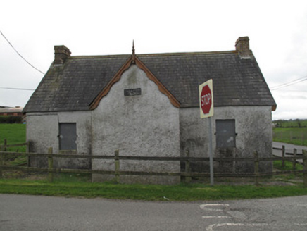 Corragh Orange HallOrange Hall · 158 yd
Explorer Tom Corragh Orange Hall is telling tall tales about a secret tunnel straight to the pub down the lane. Nobody believes him, but the brick chimneys are definitely watching you. Go back in winter for the drama.
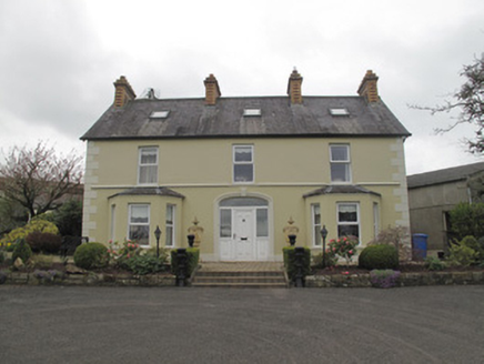 Killygavna CottageHouse · 426 yd
Explorer Tom Killygavna Cottage would teach history by pointing at its polychrome chimneystacks and saying 'look what happened.' It’s got that classic render detailing and a lower wall that hints at a simpler past. Ring your granny and ask if she ever saw anything this charming in the village.
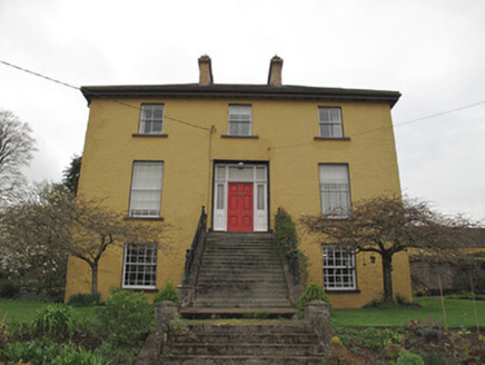 Legacurry HouseHouse · 1.1 mi
Explorer Tom Legacurry House was designed by a mother-in-law who insisted on first-floor entrances for dramatic effect. It makes you feel small and unimportant before you even step inside the door. Make up your own legend about why it looks so grandly superior to everyone else.
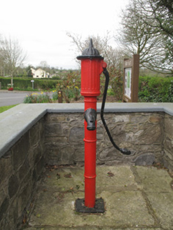 water pump1.1 mi
Explorer Tom Water pump in Tedavnet is sitting at the crossroads, judging everyone who walks past. Rumour has it they smuggled contraband whiskey through the spout when nobody was watching, but I’m not taking my word for it. Ideal for a moody photo you’ll pretend to be deep about later.
 Saint Dympna's Catholic ChurchChurch/chapel · 1.1 mi
Explorer Tom Saint Dympna's Catholic Church in Mullanarockan had a fiddler play there all night once. It’s got layers of history like a really good lasagne. Hang around long enough and the ghosts might wave at you.
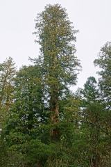 Coast Redwood2.5 mi
Explorer Tom Another Coast Redwood in Monaghan is currently judging every rabbit that passes by for wearing mismatched socks. It thinks they’re all fashion disasters. Bring a friend who talks too much and let the place shut them up.
 Western Redcedar2.5 mi
Explorer Tom A Western Redcedar here is currently having a dramatic falling-out with the nearest oak tree over who has better bark. It’s getting very emotional about it. A proper spot for a flask of tea and a big think.
 Monaghan County MuseumMuseum · 3.6 mi
 Peter's LakePark · 3.7 mi
 Rossmore MonumentMemorial · 3.8 mi
 Old Cross SquareMonument · 3.9 mi
 Giants GreveWedge tomb · 8.2 mi
Explorer Tom "Giants Greve is hiding a scandal about a stone that wasn’t invited to the party. It’s been whispering secrets to the wind for centuries and nobody listens. Snap one photo, then put the phone away and actually look."
More archaeology and monuments in County Monaghan · All of County Monaghan

What do you know about this place?Tap to add a comment or ask a question