
Places near here
Photo credits
- National Inventory of Architectural Heritage
- Oliver Dixon, Geograph · CC BY-SA 2.0
- Mike Searle, Geograph · CC BY-SA 2.0
- Christian Pirkl, Wikimedia Commons · CC BY-SA 3.0 at
- Mike Searle, Wikimedia Commons · CC BY-SA 2.0
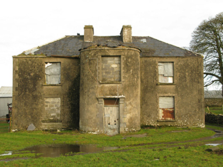 Beech GroveFarm house · 755 yd
Explorer Tom Beech Grove in Cornalassan has massive opinions on your modern architecture, darling. It’s a dilapidated farmhouse with a curvilinear breakfront that screams 'I’m fancy but tired.' The sparrow-pecked doorcase is basically its personality. Ring your grandmother if you see it.
Ballinlassa FortArchaeological place · 1141 ydEnclosure in BellanaloobEnclosure · 1293 ydExplorer Tom Enclosure in Bellanaloob is proud of being the only thing in the field that hasn't moved since the Bronze Age. It’s basically invisible now, which is its whole brand. Ideal for a moody photo you'll pretend wasn't posed.
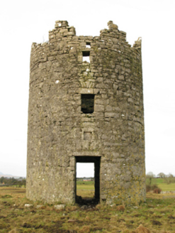 Newbrook HouseMill (wind) · 1382 ydCreevagh IslandIslet · 3.4 miConnors IslandIslet · 3.5 mi
 Moore Hall Forest TrailWalking route · 3.8 miKiltoom PointHeadland · 3.8 mi
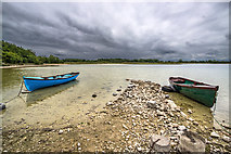 Moore Hall ForestForest · 3.9 mi
 Sycamore3.9 mi
Explorer Tom Sycamore’s least favourite visitor is definitely the guy who tries to climb it in his dress shoes and complains about the leaves. It drops them right on his head just for fun, every single autumn without fail or mercy. It's the kind of place that makes a dull Tuesday interesting.
 Cloonagashel CastleCastle · 4.0 mi
 Castle CarraCastle · 5.1 mi
More archaeology and monuments in County Mayo · All of County Mayo

What do you know about this place?Tap to add a comment or ask a question