
Places near here
Photo credits
- National Inventory of Architectural Heritage
- Grose, Francis, 1731?-1791; Ledwich, Edward, 1738-1823, continuator, Wikimedia Commons · Public domain
- Willow, Wikimedia Commons · CC BY 2.5
- John M, Geograph · CC BY-SA 2.0
- Fifiheavey, Wikimedia Commons · CC BY-SA 4.0
- Pampuco, Wikimedia Commons · CC BY-SA 4.0
CastleforeCastle, tower house · 1.1 mi Annadale HouseCountry house · 1.5 miBuck IslandIsland · 1.5 miAghacashel HouseCountry house · 2.1 miCastle JohnCastle · 2.2 miEuropean ash3.1 miFinn McCool's MonumentArchaeological place · 3.2 miGraveyard3.6 miCromlin Bridge WoodWood · 3.8 miDrumbadMountain / peak · 4.0 miSliabh an IarainnMountain / peak · 4.0 mi
Explorer Tom Castlefore in Kilmacsherwell has made its New Year's resolution to finally collapse into the ground. It’s been hiding in the pasture since 1409, waiting for someone to notice it exists. Toast it with a cup of tea and move on to the next.
Crane IslandIslet · 1.5 mi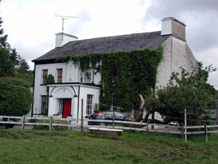 Annadale HouseCountry house · 1.5 miBuck IslandIsland · 1.5 mi
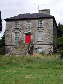 Aghacashel HouseCountry house · 2.1 mi
 Castle JohnCastle · 2.2 mi
 European ash3.1 mi
Explorer Tom European Ash has a secret talent for looking impressive while doing absolutely nothing at all. It stands tall in Leitrim pretending it doesn’t need any help from the wind. Have a wander and a wonder.
 Finn McCool's MonumentArchaeological place · 3.2 mi
 Graveyard3.6 miCromlin Bridge WoodWood · 3.8 miDrumbadMountain / peak · 4.0 mi
 Sliabh an IarainnMountain / peak · 4.0 mi
More archaeology and monuments in County Leitrim · All of County Leitrim

What do you know about this place?Tap to add a comment or ask a question