What is recorded here
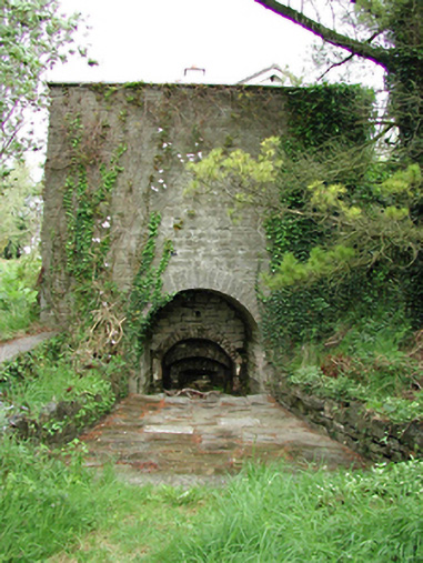
Annotated ‘L.K.’ on the 1863 edition of the OS 25-inch map where a rectangular-shaped kiln is depicted standing immediately to the south of a quarry. Limekiln not depicted on the 1837 edition of the Ordnance Survey six-inch map. Kiln visible on the 2013-18 MapGenie orthoimage where it is now located in a green area of landscaping associated with modern housing estate.
19th-century limekiln described by the National Inventory of Architectural Heritage (NIAH) as a; ‘Detached lime kiln, c.1820, on a square plan, now partially incorporated into the modern house to rere. Opening at base comprises sequence of four recessed arches with dressed voussoir blocks, set into squared limestone rubble construction. Limestone paved area to front of opening’ (NIAH Reg. No. 11204003).
Compiled by: Caimin O'Brien
Date of Compilation: 26 November 2025
The monument record does not grant public access. Check the route and ask the landowner before entering private land.
- What survives
- Recorded monument
Places near here
 kilnkiln · 7 yd
 Enclosure in CooldrinaghEnclosure · 205 yd
 IndicatedKiln, lime · 383 yd
 TobermacluggHoly well · 628 yd
 Sli Na Sláinte Leixlip Lucan DesmenseWalking route · 849 yd
 Lucan DemenseHeritage attraction · 1095 yd
 Sli Na Sláinte Leixlip SliWalking route · 1430 yd
 Guinness' BreweryMemorial · 1473 yd
 Leixlip MonumentMemorial · 1555 yd
 CastleCastle, unclassified · 1617 yd
 Squirrel WoodWood · 1.3 mi
 The Wonderful BarnHeritage attraction · 1.5 mi