
Places near here
Photo credits
- National Inventory of Architectural Heritage
- Kmcnamee, Wikimedia Commons · CC BY-SA 4.0
- Jonathan Thacker, Geograph · CC BY-SA 2.0
- Mike Searle, Wikimedia Commons · CC BY-SA 2.0
- Jonathan Thacker, Geograph · Creative Commons Attribution-ShareAlike 2.0
- Eeno11, Wikimedia Commons · CC BY-SA 3.0
- Colin Park, Geograph · CC BY-SA 2.0
Explorer Tom Lisabram is basically a fancy mud circle with a little mound inside, pretending it’s something grander. It’s got a…
 Charles's BridgeBridge · 1691 yd
Explorer Tom Charles's Bridge is all about round arches and sandstone cutwaters that look very fancy. It’s been carrying traffic…
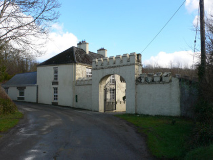 Duarrigle CastleGate lodge · 1.1 mi
Explorer Tom Duarrigle Castle gate lodge has a castellated addition that looks like someone added a toy castle roof to a normal…
 Cullen GAA pitchGAA ground · 1.7 miSt. John's GAA pitchGAA ground · 2.9 mi
 Claragh MountainMountain / peak · 3.0 mi
Explorer Tom Claragh Mountain rises behind Millstreet in County Cork, close enough to town that Tom thought the summit might accept…
 St. Patrick's ChurchVisitor information · 3.0 mi
Explorer Tom St. Patrick's Church has an ongoing feud with the rain because it keeps getting wet and grumpy. The building looks like…
 Castle and TurretCastle, tower house · 3.1 mi
Explorer Tom Castle and Turret in Drishane More was built by Mac Carthys in 1450, or so tradition claims. Now it's attached to an…
 Grave YardGraveyard · 3.3 mi
Explorer Tom Graveyard in Drishane More was part of a convent's grounds. Oldest stone dates to 1725. Nuns were buried on the east…
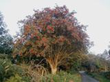 Rowan3.6 mi
Explorer Tom Rowan in County Cork bragged about surviving a storm that was actually just a strong breeze and a lot of wind noise.…
 CurracahillMountain / peak · 4.0 mi
Explorer Tom Currahill would teach history by making everyone climb up while reciting dates, then erasing them if they got one…
 Kilmeedy CastleCastle, tower house · 4.1 mi
Explorer Tom Kilmeedy Castle was designed by a mother-in-law who really needed everyone to know where the door was, so she added a…
More archaeology and monuments in County Cork · All of County Cork

What do you know about this place?Tap to add a comment or ask a question