
Places near here
Photo credits
- National Inventory of Architectural Heritage
- Reading Tom, Wikimedia Commons · CC BY 2.0
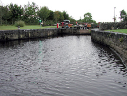 Albert LockLock · 348 yd
Explorer Tom Albert Lock in Cloonteem would be the person at a wedding who keeps checking their watch because they’re running late to the next lock. Fourth-generation keeper business is tough, but those limestone blocks are massive enough to impress anyone who doesn’t know what navigation actually means. Wave at the water and hope it flows your way!
Enclosure in CloonteemEnclosure · 742 ydExplorer Tom Enclosure in Cloonteem was the escape plan for its first owner, who probably ran straight into the River Shannon behind it. It’s a crescent-shaped bank attached to another rath, looking like a very confused comma. Have a nosey, politely.
Embanked enclosureFairy fort / earthen ringfort · 1032 ydExplorer Tom Embanked enclosure in Lackagh has an unlikely celebrity friend who is just a drain running outside. It’s got rushes growing on its fosses, which is very high maintenance. Stand there long enough and someone will ask if you're lost.
Wildlife AreaNature reserve · 1066 ydTom Dunphy MemorialMemorial · 1141 yd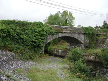 bridge1189 yd
Explorer Tom Bridge in Corry in Roscommon has more arch than your average job interview answer, mate. It’s got that heavy bottom and light top thing going on, like it’s trying to impress the canal but failing. Keep your eyes peeled for that masonry flex!
Patrick Gill Memorial Plaque (ira)Monument · 1620 ydSite of Dangan CastleCastle, unclassified · 1.9 miExplorer Tom Site of Dangan Castle wants its tombstone to say 'He Was A Stronghold And Also A Bit Of A Mess', which is very accurate. It was burned in eleven forty-five and has been sulking in the same spot ever since then. Perfect place to be dramatically windswept.
InishmoylinIslet · 3.1 miExplorer Tom Inishmoylin in County Roscommon would tell its younger self to stop worrying about being an islet and just enjoy the view from the water. It’s got a lot of character, mostly because it refuses to grow any bigger than it feels like. Sit on a wall near it and pretend you're in a painting.
Coarse IslandForest · 3.3 miExplorer Tom Coarse Island in County Roscommon is being dramatic about its own name. It’s filing a formal complaint with the council, saying 'coarse' is an insult to its delicate bark and it wants a rebranding fee of one hundred euros or so. Bring a coin for luck and keep it in your pocket.
Dockery's IslandIslet · 3.4 miExplorer Tom Dockery's Island is famous locally because a poet fell into the ditch right next to it while trying to write a sonnet about the sunset. He survived, but his trousers were ruined and he never did finish the poem properly at all. Take a mate and argue about what it was for.
 Cavan & Leitrim RailwayMuseum · 5.1 mi
More archaeology and monuments in County Roscommon · All of County Roscommon

What do you know about this place?Tap to add a comment or ask a question