What is recorded here
At the bottom of the W-facing slope of a drumlin with the River Shannon immediately to the W. Crescent-shaped grass-covered area (dims. c. 40m N-S; 7.5m E-W) defined by an earthen bank (Wth 3.5m; 0.3m) at S and a scarp (H 0.2-0.5m) SW-N attached to the SW of rath (RO012-006001-).
From the National Monuments Service (Archaeological Survey of Ireland) record RO012-006002
The monument record does not grant public access. Check the route and ask the landowner before entering private land.
- What survives
- Recorded monument
Places near here
Wildlife AreaNature reserve · 523 ydIndicatedEnclosure · 662 ydTom Dunphy MemorialMemorial · 768 ydEmbanked enclosureFairy fort / earthen ringfort · 781 yd Saint Anne's Church (Annaduff)Church/chapel · 853 ydgraveyard/cemetery982 ydPatrick Gill Memorial Plaque (ira)Monument · 1026 ydSite of Dangan CastleCastle, unclassified · 2.2 miInishmoylinIslet · 3.5 miCastlecarraCastle, unclassified · 3.6 miCavan & Leitrim RailwayMuseum · 5.4 miShannon-Erne WaterwayVisitor information · 5.6 mi
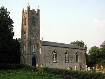 Saint Anne's Church (Annaduff)Church/chapel · 853 yd
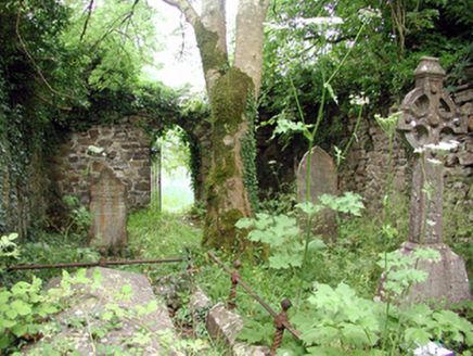 graveyard/cemetery982 ydPatrick Gill Memorial Plaque (ira)Monument · 1026 ydSite of Dangan CastleCastle, unclassified · 2.2 miInishmoylinIslet · 3.5 miCastlecarraCastle, unclassified · 3.6 mi
 Cavan & Leitrim RailwayMuseum · 5.4 mi
 Shannon-Erne WaterwayVisitor information · 5.6 mi
Pictures: National Inventory of Architectural Heritage; Reading Tom, Wikimedia Commons · CC BY 2.0; Suse, Geograph · CC BY-SA 2.0
More archaeology and monuments in County Roscommon · All of County Roscommon
What do you know about this place?