What is recorded here
In pasture, prominently sited on top of a hillock with excellent views in all directions. Raised circular area (30.5m N–S; 29m E–W) defined by a substantial earthen bank and enclosed by a fosse with possible remnants of an external bank. The inner bank (Wth 4m at N, 5.9m at S; int. H 0.45-0.5m at N & S; ext. H 2.8m at…
Read the whole record
In pasture, prominently sited on top of a hillock with excellent views in all directions. Raised circular area (30.5m N–S; 29m E–W) defined by a substantial earthen bank and enclosed by a fosse with possible remnants of an external bank. The inner bank (Wth 4m at N, 5.9m at S; int. H 0.45-0.5m at N & S; ext. H 2.8m at N & S, 3.3m at W) has a pronounced external scarp, enhanced by the natural slope of the hillock, but is low internally with sections at E and SW reduced to a scarp. Stones protrude along the top of the bank. At NE–ENE a rough, intermittent kerb of large stones is evident at the base of the external slope of the bank. The fosse can be traced at SSW-E as a low terrace (Wth 1.6-2m at SW-N, 3.5-4m at E). At W–N the outer edge of the fosse is bordered by an earth and stone field fence (Wth 1.6m; int. H 0.9m; ext. H 1.2m) that respects the curve of the rath and may preserve the line of an original external bank. A gap (Wth 1.4m) in the inner bank at SE appears to mark an original entrance, coinciding with a large break in the fosse and with a low rise or undulation that provides a natural causeway or access ramp. A row of stones, partly engulfed in overgrowth, extends from the E side of the entrance gap to SE for a few meters, set adjacent and parallel to a NW–SE field fence that abuts the rath at SE. The SW quadrant of the interior is at a slightly higher level to the rest of the level interior, demarcated on the E side a low irregular scarp (H 0.45m) and on the W side by a shallow, irregular-shaped depression (Wth c. 1-1.5m) which extends for 9m to SW towards the rath bank at SW. There is a slight, ill-defined hollow close to the inner face of the bank at S.
The rath interior is grassy, with moderate gorse around the perimeter.
From the National Monuments Service (Archaeological Survey of Ireland) record MA071-030
Places near here
Photo credits
- National Inventory of Architectural Heritage
- JohnArmagh, Wikimedia Commons · CC BY-SA 3.0
- Pamela Norrington, Geograph · Creative Commons Attribution-ShareAlike 2.0
- Pamela Norrington, Geograph · CC BY-SA 2.0
- Didier Descouens, Wikimedia Commons · CC BY-SA 4.0
 Saint Luke's Catholic ChurchChurch/chapel · 793 yd
 Round Tower1038 yd
 bridge1717 yd
 Thorn CaveCave · 2.5 miYouth Memorial GardenMemorial · 2.5 mi
 Grave YardGraveyard · 2.6 miBrabazon WoodsForest · 2.8 miProcession Of The SoulsMemorial · 2.9 miCastle in ruinsCastle, tower house · 3.1 mi
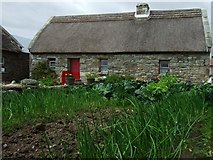 Hennigan's Heritage CentreHeritage attraction · 3.4 mi
 Hawthorn3.4 mi
 Ballylahan Castle in RuinsCastle, Anglo-Norman masonry castle · 3.9 mi
More archaeology and monuments in County Mayo · All of County Mayo
What do you know about this place?Tap to add a comment or ask a question