
Places near here
Photo credits
- Jonathan Billinger, Wikimedia Commons · CC BY-SA 2.0
- Sarah777 at English Wikipedia, Wikimedia Commons · Public domain
- National Inventory of Architectural Heritage
- surrealpenguin, Wikimedia Commons · CC BY-SA 2.0
- Kmcnamee, Wikimedia Commons · CC BY-SA 4.0
- Ian Brooker and David Kleinig, Wikimedia Commons · CC BY 3.0 au
 Monalee HillMountain / peak · 1238 yd
Explorer Tom Monalee Hill suspects the postman is stealing letters and hiding them in the turf. It’s been glaring at the road every…
Embanked enclosureFairy fort / stone ringfort · 1513 ydExplorer Tom Embanked enclosure in Annaghgap overlooks the Wicklow Gap from a NE-facing slope, looking like a circular fortress…
Double-bank enclosureFairy fort / earthen ringfort · 1.2 miExplorer Tom Double-bank enclosure in Ballyrory has such a long list of former names that the paperwork alone could fill a library…
 Annagh HillMountain / peak · 1.5 mi
Explorer Tom Annagh Hill above Ballyfad offers woodland climbing, open views and a hurling tale bold enough to make Tom suspicious…
CastleCastle, motte · 1.5 miExplorer Tom Castle in Pallis Lower is a quarried mound that looks like it’s been chewed on by a very large, angry goat. It’s got a…
 graveyard/cemetery1.8 mi
Explorer Tom Graveyard or cemetery in Glebe has a hidden message in its stones, but only the really stubborn dead can read it…
 rectory/glebe/vicarage/curate's house1.9 mi
Explorer Tom Rectory in Glebe would tell you after three pints that it actually hates the view and just pretends to like it for…
White Heaps 1798Memorial · 2.4 miExplorer Tom White Heaps 1798 has a memorial with a bird that absolutely refuses to leave, no matter how much you shoo it away. It’s…
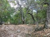 Persian Walnut3.0 mi
Explorer Tom Persian Walnut in County Wexford had a fiddler playing all night until the locals threatened to throw rocks at him. He…
 Kilanerin-Ballyfad GAAGAA ground · 3.2 miCoolboy Community Field, Shillelagh-Coolboy GAAGAA ground · 3.5 mi
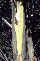 Johnston's gum3.8 mi
Explorer Tom Johnston's gum in County Wexford must have taken about four billion cups of tea to build, judging by how thick that…
More archaeology and monuments in County Wexford · All of County Wexford

What do you know about this place?Tap to add a comment or ask a question