What is recorded here
Marked as a double-banked enclosure (ext. diam. c. 60m) on the 1839 ed. of the OS 6-inch map and visible as a feature on vertical aerial photographs (GSIAP T38/39). Situated at the bottom of a N and W-facing slope. This is a slightly raised, circular, grass-covered area (diam. 35m N-S) defined by a low bank (Wth 6-7m; H 0.5m) with an external fosse (Wth of top 6m; D 0.3m), which is not visible NE–SE. There is an entrance (Wth 4.5m) at NE. It is also visible on Bing images (2011). Michael Moore
Date of upload/revision: 27 January 2012
Marked as a double-banked enclosure (ext. diam. c. 60m) on the 1839 ed. of the OS 6-inch map and visible as a feature on vertical aerial photographs (GSIAP T38/39). Situated at the bottom of a N and W-facing slope. This is a slightly raised, circular, grass-covered area (diam. 35m N-S) defined by a low bank (Wth 6-7m; H 0.5m) with an external fosse (Wth of top 6m; D 0.3m), which is not visible NE–SE. There is an…
From the National Monuments Service (Archaeological Survey of Ireland) record WX002-009
The monument record does not grant public access. Check the route and ask the landowner before entering private land.
- What survives
- Recorded monument
Places near here
Photo credits
- National Inventory of Architectural Heritage
- Sarah777 at English Wikipedia, Wikimedia Commons · Public domain
- Jonathan Billinger, Wikimedia Commons · CC BY-SA 2.0
- surrealpenguin, Wikimedia Commons · CC BY-SA 2.0
- Ian Brooker and David Kleinig, Wikimedia Commons · CC BY 3.0 au
Embanked enclosureFairy fort / stone ringfort · 1559 yd Wingfield HouseFarm house · 1611 ydAnnagh HillMountain / peak · 1.1 miEmbanked enclosureFairy fort / earthen ringfort · 1.2 mi1798 MemorialMemorial · 1.2 miBarnadown HouseGates/railings/walls · 1.5 miMonalee HillMountain / peak · 1.6 miCastleCastle, motte · 2.7 mi(Site of) Raymond CastleCastle, unclassified · 2.8 miWhite Heaps 1798Memorial · 3.5 miPersian Walnut4.0 miJohnston's gum4.7 mi
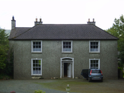 Wingfield HouseFarm house · 1611 yd
 Annagh HillMountain / peak · 1.1 miEmbanked enclosureFairy fort / earthen ringfort · 1.2 mi1798 MemorialMemorial · 1.2 mi
 Barnadown HouseGates/railings/walls · 1.5 mi
 Monalee HillMountain / peak · 1.6 miCastleCastle, motte · 2.7 mi(Site of) Raymond CastleCastle, unclassified · 2.8 miWhite Heaps 1798Memorial · 3.5 mi
 Persian Walnut4.0 mi
 Johnston's gum4.7 mi
More archaeology and monuments in County Wexford · All of County Wexford
What do you know about this place?