Places near here
Photo credits
- National Inventory of Architectural Heritage
- liam murphy, Wikimedia Commons · CC BY-SA 2.0
- 瑞丽江的河水, Wikimedia Commons · CC BY-SA 4.0
- Andreas F. Borchert, Wikimedia Commons · CC BY-SA 4.0
- Kmcnamee, Wikimedia Commons · CC BY-SA 4.0
 Doran's BridgeBridge · 814 yd
Explorer Tom Doran's Bridge has one least favourite visitor: any tourist who thinks they can touch the fieldstone without washing…
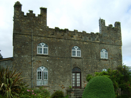 Killoggy CastleFarm house · 1652 yd
Explorer Tom Killoggy Castle is a farmhouse that looks like a miniature fort and its favorite song is 'We Will Rock You' because it…
 KnockardaghHouse · 1672 yd
Explorer Tom Knockardagh in Castleland keeps complaining that the wind is picking on it because it’s too round and bouncy for its…
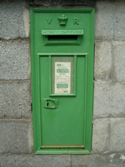 post box1.0 mi
Explorer Tom Post box in Ferns Upper is sitting there quietly while two families argue about who has the best view of it. It doesn’t…
 Bank of IrelandBank/financial institution · 1.0 mi
Explorer Tom Bank of Ireland in Ferns Upper is guarding a treasure chest that is definitely just an empty biscuit tin and some old…
 Father John Murphy MonumentMonument · 1.0 mi
Explorer Tom Father John Murphy Monument in Coolbaun has an unlikely celebrity friend: a very confused goat that used to live behind…
 Ferns CastleVisitor attraction · 1.0 mi
Explorer Tom Ferns Castle had a massive feud with the next village over something completely daft like whose turn it was to repair a…
 Ferns Castle (in ruins)Castle, Anglo-Norman masonry castle · 1.0 mi
Explorer Tom Ferns Castle’s secret talent is surviving every single siege by hiding behind a very convincing disguise as a regular…
 St. Augustines Monastery (in ruins)Religious house, Augustinian canons · 1.1 mi
Explorer Tom St. Augustines Monastery in Ferns is sick of people asking if they still serve breakfast; it’s just ruins now, mate.…
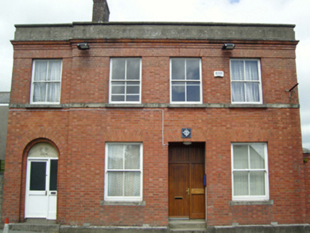 Ferns Garda Síochána StationPost office · 1.1 mi
Explorer Tom Ferns Garda Station used to be a post office, which is a wild twist that still confuses the locals every single time…
 Saint Edan's Cathedral (Ferns)Cathedral · 1.1 mi
Explorer Tom Saint Edan’s Cathedral is built on the footings of a thirteenth-century church because giants used to live there and…
 St. Aidan's GAA, FernsGAA ground · 1.2 mi
More archaeology and monuments in County Wexford · All of County Wexford

What do you know about this place?Tap to add a comment or ask a question