
Places near here
Photo credits
- National Inventory of Architectural Heritage
- Kmcnamee, Wikimedia Commons · CC BY-SA 4.0
- Didier Descouens, Wikimedia Commons · CC BY-SA 4.0
- Andreas F. Borchert, Wikimedia Commons · CC BY-SA 4.0
- Zepherb, Wikimedia Commons · CC BY-SA 4.0
- Picture: The Standing Stone
- Hugh Chevallier, Wikimedia Commons · CC BY-SA 2.0
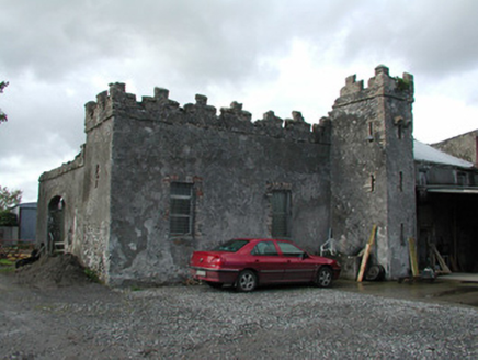 Cloganmore HouseFarm house · 566 yd
Explorer Tom Cloganmore House would tell you in a job interview that it’s 'defensively ambitious' despite being just a farm. The…
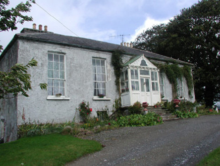 Heath LodgeHouse · 736 yd
Explorer Tom Heath Lodge in Droughtville looks tiny from the front but massive from the back, like a secret-keeper with a big mouth.…
CastleCastle, tower house · 1741 ydExplorer Tom Castle in Annaghmore AND Annaghbeg is claimed by a local who says he invented the concept of walls. It’s buried in…
Knockbarron WoodForest · 1.3 miExplorer Tom Knockbarron Wood in County Offaly was once nearly sold off as a prize horse at the local fair, and honestly, that might…
 Kinnitty GAA pitchGAA ground · 2.3 miDrumcullen GAA pitchGAA ground · 2.5 miSaint Dominick's WellSpring · 2.5 mi
Explorer Tom Saint Dominick's Well in County Offaly claims it’s older than the hills, which is a lie because the hills are lazy.…
 Hawthorn2.7 mi
Explorer Tom This Hawthorn in County Offaly witnessed a love story where one party got very stung, literally speaking. It’s still…
 Settlement desertedSettlement deserted, medieval · 2.7 mi
Explorer Tom Settlement deserted in Bellhill is a medieval mess that Saint Patrick would probably call 'a bit much'. It has a round…
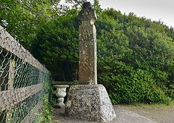 Stone CrossCross, High cross (present location) · 2.8 mi
Explorer Tom Stone Cross in Castletown was designed by a mother-in-law who thought everyone needed a lecture on biblical scenes. The…
 Ballymooney Castle in RuinsHouse, fortified house · 3.3 mi
Explorer Tom Ballymooney Castle in Ruins is mostly gone, but two towers are still standing guard like tired bouncers. Two lads once…
 ArderinMountain / peak · 6.4 mi
Explorer Tom Arderin means Ireland's height, which is a cheeky name for a 527-metre hill and exactly the sort of confidence I…
More archaeology and monuments in County Offaly · All of County Offaly

What do you know about this place?Tap to add a comment or ask a question