What is recorded here
Built, probably c. 1600-1610, by Sir Charles Coote. His son, Sir Charles, was besieged here by Con O'Rourke in 1641 and again in 1643 by John Burke, both of whom failed to capture it. The original house was burned in 1798, being replaced by a farmhouse which is still occupied. It is situated on a rise overlooking the NW-SE Boyle river, c. 150m to the SW. The remains consist of the square bawn (int. dims. 57m N-S; 57m E-W) defined by masonry walls which survive almost complete (H c. 3m; T 0.8m) at the N and E sides, and at the N end of the W side. The N wall has its original eight gun-loops, with surviving totals of four on the E and three on the W walls. The SE corner tower is incorporated in the present dwelling but the NE and NW circular towers (int. diam. 3.9m) have two storeys, with three gun-loops on each ground floor and fireplaces on the first. A fragment of the original house (RO007-015001-) consisting of a chimney stack straddles the line of the S bawn wall, where the original entrance to the bawn was probably located. Archaeological testing c. 20-40m S of the bawn produced post-medieval maerial (Read 2008c), while testing c. 150-300m to the SE-S produced no archaeological material (Read 2009c; Delaney 2008, 2009b). Archaeological testing during 2008 on the line of the bawn wall at E produced evidence of the bawn wall and internal features (Read 2011b). (Grose 1791, 82-4; D'Alton 1845, 118-9)
Compiled by: Michael Moore
Date of upload: 20th June, 2011.
From the National Monuments Service (Archaeological Survey of Ireland) record RO007-015002
The monument record does not grant public access. Check the route and ask the landowner before entering private land.
- What survives
- Recorded monument
Places near here
Photo credits
- National Inventory of Architectural Heritage
- Alan Murray-Rust, Geograph · CC BY-SA 2.0
- Stephan van Helden, Wikimedia Commons · CC BY-SA 4.0
- abdallahh from Montréal, Canada, Wikimedia Commons · CC BY 2.0
- jbraine, Wikimedia Commons · CC BY 2.0
- Unknown Weaver, English (active c. 1080), Wikimedia Commons · Public domain
- Suse, Geograph · CC BY-SA 2.0
- Oliver Dixon, Geograph · CC BY-SA 2.0
- Kieran Campbell, Geograph · Creative Commons Attribution-ShareAlike 2.0
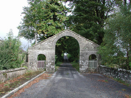 The BawnDemesne walls/gates/railings · 172 yd
 Cootehall BridgeBridge · 315 ydEmbanked enclosureFairy fort / earthen ringfort · 597 yd
 Horse-chestnut3.0 mi
 Western Redcedar3.1 miSwallow IslandIslet · 3.1 mi
 Lough Key Forest ParkWood · 3.4 mi
_-_WGA24165.jpg/250px-Tapestry_by_unknown_weaver_-_The_Bayeux_Tapestry_(detail)_-_WGA24165.jpg "Photo: Unknown Weaver, English (active c. 1080), Wikimedia Commons · Public domain") Battle of Áth an ChipBattle · 3.5 miPortCastle, unclassified · 3.6 mi
Battle of Áth an ChipBattle · 3.5 miPortCastle, unclassified · 3.6 mi Shannon-Erne WaterwayVisitor information · 4.0 mi
 Hog's IslandIslet · 4.1 mi
 IndicatedGraveyard · 4.3 mi
More castles and forts in County Roscommon · All of County Roscommon
What do you know about this place?