What is recorded here
From the National Monuments Service (Archaeological Survey of Ireland) record CO072-111002
Places near here
Photo credits
- National Inventory of Architectural Heritage
- David P Howard, Geograph · CC BY-SA 2.0
- Jonathan Thacker, Geograph · Creative Commons Attribution-ShareAlike 2.0
- Jonathan Thacker, Wikimedia Commons · CC BY-SA 2.0
- Richard Fensome, Wikimedia Commons · CC BY-SA 2.0
- Jonathan Thacker, Geograph · CC BY-SA 2.0
- Mike Searle, Wikimedia Commons · CC BY-SA 2.0
- Hywel Williams, Wikimedia Commons · CC BY-SA 2.0
 Clashanure HouseCountry house · 968 yd
Explorer Tom Clashanure House is all about symmetry and order, with slate roofs that look like they’re ready for a very fancy country wedding. It’s got timber panelled shutters that probably hide more secrets than your ex-partner does. Keep an eye out for the biscuit tin!
Bob AdamsMemorial · 1.0 mi Valley View HouseHouse · 1.5 mi
Explorer Tom Valley View House is showing off its oriel window in Lackenareague. From around 1910, it’s got that Arts and Crafts vibe with red roof tiles. It’s a delightful addition to the area, definitely worth a peek!
Coachford Greenway (End)Visitor information · 1.5 mi Farran WoodWood · 1.9 miIniscarra Dam ViewViewpoint · 2.0 mi
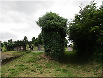 Grave YardGraveyard · 2.5 mi
Explorer Tom Graveyard in Aglish sits on a ridge, watching the Lee valley while pretending it isn’t also a church ruin. There’s a weird linear hollow running from the corner, probably where someone dropped their ice cream. Bring your own legend, I've run out.
 Kilcrea FriaryGraveyard · 2.6 mi
 Kilcrea CastleWood · 2.6 mi
 Kilcrea Castle (in Ruins)Castle, tower house · 2.6 mi
Explorer Tom Kilcrea Castle sits on a mound surrounded by water, looking very important and slightly damp. The bird that refuses to leave has better manners than most tourists. Ring your granny and tell her where you are.
 Carrignamuck Tower HouseCastle · 2.6 mi
Explorer Tom Carrignamuck Tower House in County Cork was breached by Lord Broghill in 1650. It's now in Dripsey Castle's grounds. Take a photo for me if you can find the hole in the east wall!
 St Olans WellHoly well · 5.7 mi
Explorer Tom St Olans Well is surrounded by stone and votive offerings, making it look a bit like an ancient jewelry box. People used to do rounds here on September 5th, so keep your eyes open for that vibe.
More historic places in County Cork · All of County Cork

What do you know about this place?Tap to add a comment or ask a question