What is recorded here
Marked as a D-shaped embanked enclosure (ext. dims. c. 40m E-W; c. 30m N-S) truncated by an E-W field bank at S on the 1840 ed. of the OS 6-inch map. Situated on a severe N-facing slope down to the floodplain of the W-E River Suir. Oval grass-covered area (dims. 27m E-W; 21m N-S) defined by a slight scarp (max. H 0.3m).
From the National Monuments Service (Archaeological Survey of Ireland) record WA003-003
The monument record does not grant public access. Check the route and ask the landowner before entering private land.
- What survives
- Recorded monument
Places near here
 Glencomeragh HouseHouse · 699 ydSite of ChurchChurch · 722 ydMaurice DavinMemorial · 776 yd
 Dysart HouseOfficially recorded historic building · 947 yd
 Coolnamuck Castle (in Ruins)Castle, tower house · 2.1 mi
 Castle (in ruins)Castle, tower house · 2.3 mi
 Pedunculate Oak2.3 mi
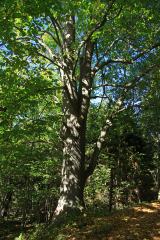 Large-leaved Lime3.3 mi
 Grave YardGraveyard · 3.4 mi
 Ormonde CastleHeritage attraction · 4.5 mi
 KnocksheegownaMountain / peak · 4.8 mi
 KnockanaffrinMountain / peak · 5.1 mi
Pictures: National Inventory of Architectural Heritage; John M, Geograph · CC BY-SA 2.0; kevin higgins, Geograph · CC BY-SA 2.0; Algirdas at Lithuanian Wikipedia, Wikimedia Commons · Public domain; Chmee2, Wikimedia Commons · CC BY-SA 3.0; Humphrey Bolton, Geograph · Creative Commons Attribution-ShareAlike 2.0; Humphrey Bolton, Wikimedia Commons · CC BY-SA 2.0; Colin Park, Geograph · CC BY-SA 2.0
More archaeology and monuments in County Waterford · All of County Waterford
What do you know about this place?