
Places near here
Photo credits
- National Inventory of Architectural Heritage
- EamonnPKeane, Wikimedia Commons · CC0
- Mike Searle, Wikimedia Commons · CC BY-SA 2.0
- No machine-readable author provided. Christian1965~commonswiki assumed (based on copyright claims)., Wikimedia Commons · Public domain
- Hywel Williams, Geograph · Creative Commons Attribution-ShareAlike 2.0
- Colin Park, Geograph · CC BY-SA 2.0
- CaitNi, Wikimedia Commons · CC BY-SA 4.0
Explorer Tom Carrickittle Rock has strict rules: no talking above a whisper and absolutely no tripping. It’s one of the oldest things around, so it expects you to bow slightly. Bring a friend who talks too much and let the place shut them up.
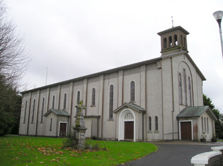 Catholic Church of Saint Patrick and Saint BrigidChurch/chapel · 1.2 mi
 The PresbyteryHouse · 1.3 mi
Explorer Tom The Presbytery in Kilteely refuses to fall down because it’s too proud to admit defeat. Those timber sliding sash windows are ancient and full of secrets about old priests. Wave at the cows, they're the real owners here now.
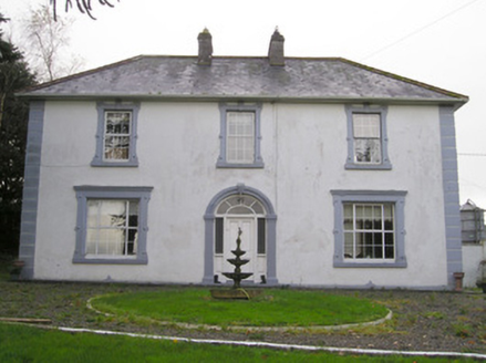 Ballinlough HouseHouse · 1.4 miSt. Patrick's WellSpring · 1.5 mi
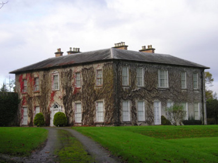 DerkCountry house · 2.0 mi
Explorer Tom Derk is so grand it makes map makers want to cry into their compasses. The windows shrink as they go up, like a pyramid of architectural confidence. Hang around long enough and you might see the ghost of a butler.
 Standing stone in Longstone (cullen Par.)Standing stone · 3.6 mi
Explorer Tom Standing stone in Longstone is proud of being solidly set with no packing stones visible whatsoever. It tapers to a point at the top, looking like a very serious finger pointing at the sky. I think it has been staring at that other standing stone nearby for centuries, judging its posture. Pack a picnic and an excuse.
 Castle (in ruins)Castle, tower house · 5.8 mi
 Áine and Gearóid Iarla: Lough GurLegend location · 6.2 mi
Explorer Tom Áine and Gearóid Iarla: Lough Gur has a goddess for the lake and a sleeping lord in the old stories. I thought I was coming to admire water and stones. Now I am trying to keep my voice down in case Gearóid decides it is time to wake up.
 Grave YardGraveyard · 8.8 mi
 SlievereaghMountain / peak · 9.2 mi
 CarrigeenamronetyMountain / peak · 15 mi
More archaeology and monuments in County Limerick · All of County Limerick

What do you know about this place?Tap to add a comment or ask a question