What is recorded here
On a S-facing slope in a haggard located to the S of a laneway, which leads to a farmhouse further to the S. According to local information, this holy well is dedicated to St Behan and it provides a cure for skin disorders. Two penitential stations (CL016-158002-) and (CL016-158003-) are associated. The well (dims.…
Read the whole record
From the National Monuments Service (Archaeological Survey of Ireland) record CL016-158001
Places near here
Picture notes
- National Inventory of Architectural Heritage
- The Banner, Wikimedia Commons · CC BY-SA 4.0
- Colin Park, Geograph · CC BY-SA 2.0
- N Chadwick, Geograph · Creative Commons Attribution-ShareAlike 2.0
- NateBergin, Wikimedia Commons · CC BY 4.0
- N Chadwick, Geograph · CC BY-SA 2.0
- Roger Diel, Wikimedia Commons · CC BY-SA 2.0
- Gordon Hatton, Geograph · CC BY-SA 2.0
- Willow, Wikimedia Commons · CC BY 2.5
- Joseph Mischyshyn, Geograph · CC BY-SA 2.0
- Computer-made picture. It does not show this playground.
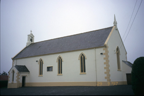 Saint Columba's Catholic ChurchChurch/chapel · 1.6 mi
Explorer Tom Peek inside Saint Columba's Catholic Church in Teerleheen to see the exposed timber hammer beam roof supporting the sacred space beautifully.
 Saint Attracta's Catholic ChurchChurch/chapel · 2.4 mi
Explorer Tom Saint Attracta's Catholic Church in Toormore is a double-height structure from around 1870, with a marble altar inside.
 Burren Centre KilfenoraVisitor information · 3.0 mi
Explorer Tom Burren Centre Kilfenora is a haven for those seeking the beauty of the Burren in County Clare
 Graveyard3.0 mi
Explorer Tom Peek through that striking pointed arch in Kilfenora’s graveyard, where huge stones anchor the wall on a quiet village slope.
 Cathedral (in ruins)Cathedral · 3.0 mi
Explorer Tom The Cathedral in Kilfenora stands as the diocesan heart since 1152, resting quietly within its graveyard.
 High CrossHeritage attraction · 3.0 mi
Explorer Tom High Cross: an ancient landmark where faith and heritage stand tall in County Clare
 Caherminnaun Castle (in ruins)Castle, unclassified · 3.3 mi
Explorer Tom Wander to Caherminnaun Castle, where O’Curry once saw only a heap of ruins and rubbish on that low limestone platform.
 Smithstown Castle (in ruins)Castle, tower house · 3.7 mi
Explorer Tom Smithstown Castle, a vanished tower house on a rocky river outcrop, once sheltered the 1st Earl of Thomond’s legacy in County Clare.
 European ash3.9 mi
Explorer Tom Picture a sturdy European ash standing tall, its branches perhaps swaying gently above some quiet corner of the county.
 Famine MemorialMemorial · 4.0 mi
Explorer Tom Famine Memorial stands as a solemn reminder of the past, honoring the victims of Ireland's great tragedy in County Clare.
 Kilmanahn GraveyardRuins · 4.1 mi
Explorer Tom Kilmanahn Graveyard: a haunting ruin where time stands still in the shadows of the past
 Children's playground5.2 miComputer-made picture. It does not show this playground.
Explorer Tom A children's playground where the joy of playing is matched only by the beauty of the surroundings.
More archaeology and monuments in County Clare · All of County Clare
What do you know about this place?Tap to add a comment or ask a question