What is recorded here
On a SE-facing slope in upland terrain, under pasture. Knockgraffon motte (TS075-019001-) is visible c. 2km to the N and tower house (TS075-076----) is visible c. 2.7km to the NE. A bivallate enclosure (diam. 25.6m N-S; 30.6m E-W) defined by an impressive steep inner bank (Wth 1.6m crest, 4.4m base; int. H 0.28m; H above fosse 2.79m); wide flat-bottomed fosse (Wth 2.5m) and steep outer bank (Wth 2.4m crest, 6m base; H above fosse 1.84m; ext. H 1.6m). There is no visible trace of an external fosse. There are a lot of loose stones lying about. While the banks appear to be largely of clay the surfaces have a high stone content. There is scrub growing around the edge of the ringfort and the interior is relatively clean, apart from nettles. There is a causewayed entrance (Wth 3.6m) in the SE quadrant, which has the remains of a possible stone lining.
On a SE-facing slope in upland terrain, under pasture. Knockgraffon motte (TS075-019001-) is visible c. 2km to the N and tower house (TS075-076----) is visible c. 2.7km to the NE. A bivallate enclosure (diam. 25.6m N-S; 30.6m E-W) defined by an impressive steep inner bank (Wth 1.6m crest, 4.4m base; int. H 0.28m; H above fosse 2.79m); wide flat-bottomed fosse (Wth 2.5m) and steep outer bank (Wth 2.4m crest, 6m…
From the National Monuments Service (Archaeological Survey of Ireland) record TS075-035
This remains an important historical record, but the official description says the monument is no longer visible or has been destroyed. The monument record does not grant public access. Check the route and ask the landowner before entering private land.
- What survives
- No visible remains or recorded as destroyed
Places near here
Photo credits
- National Inventory of Architectural Heritage
- Andreas F. Borchert, Wikimedia Commons · CC BY-SA 4.0
- Chmouel Boudjnah Original uploader was Chmouel at fr.wikipedia, Wikimedia Commons · CC BY-SA 3.0
- Sarah777, transferred by Lvova, Wikimedia Commons · Public domain
- Martin Richard Phelan, Geograph · CC BY-SA 2.0
- Benutzer:StefanServos, Wikimedia Commons · CC BY-SA 3.0
- Mike Searle, Wikimedia Commons · CC BY-SA 2.0
- Algirdas at Lithuanian Wikipedia, Wikimedia Commons · Public domain
- Sitomon, Wikimedia Commons · CC BY-SA 2.0
Field system in Caherabbey LowerField system · 885 yd Cahir AbbeyHouse · 1343 ydmill (water)1414 ydCaher AbbeyHeritage attraction · 1734 ydSiege of Cahir CastleSiege · 1.2 miKnockgraffon MotteArchaeological place · 1.3 miKnockgraffon MoatCastle, motte and bailey · 1.3 miCahir CastleCastle · 1.3 miKnockgraffon CastleCastle · 1.6 miPedunculate Oak2.2 miEuropean Yew2.5 miSlieveanard ne TopMountain / peak · 2.7 mi
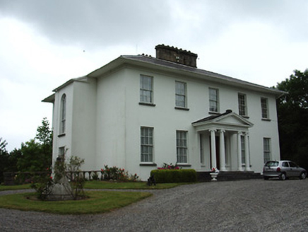 Cahir AbbeyHouse · 1343 yd
 mill (water)1414 yd
 Caher AbbeyHeritage attraction · 1734 yd
 Siege of Cahir CastleSiege · 1.2 mi
 Knockgraffon MotteArchaeological place · 1.3 mi
 Knockgraffon MoatCastle, motte and bailey · 1.3 mi
 Cahir CastleCastle · 1.3 mi
 Knockgraffon CastleCastle · 1.6 mi
 Pedunculate Oak2.2 mi
 European Yew2.5 miSlieveanard ne TopMountain / peak · 2.7 mi
More archaeology and monuments in County Tipperary · All of County Tipperary
What do you know about this place?