
Places near here
Photo credits
- Golfing in Ireland; photographer not stated, Source publisher
- National Inventory of Architectural Heritage
- Kmcnamee, Wikimedia Commons · CC BY-SA 4.0
- Mike Searle, Geograph · CC BY-SA 2.0
- Robin Pollard, Wikimedia Commons · CC BY 3.0
- Andreas F. Borchert, Wikimedia Commons · CC BY-SA 4.0
- Stephan van Helden, Wikimedia Commons · CC BY-SA 4.0
- Alvesgaspar, Wikimedia Commons · CC BY-SA 3.0
- Alex Passmore, Geograph · CC BY-SA 2.0
 Moyvalley Golf ClubGolf course · 1.1 mi
 post box1.2 mi
Explorer Tom Post box in Ballinderry is definitely where the map makers went wrong because it looks confused about its own era. King…
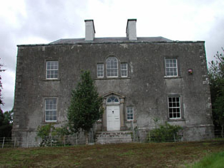 Ballinderry HouseHouse · 1.4 mi
Explorer Tom Ballinderry House in Ballinderry thinks Dublin tourists are loud and over-caffeinated, which is fair enough. It’s got…
 Balrinnet, BroadfordGAA ground · 2.9 mi
 Bawn in Newcastle (moyfenrath Lower By.)Bawn · 3.0 mi
Explorer Tom Bawn in Newcastle is actually a fancy word for a wall that forgot how to hold itself together properly. The tower house…
 IndicatedHouse, fortified house · 3.1 mi
Explorer Tom House in Carbury gave up its corbels for Lent because it felt too heavy. It’s been propping itself up on stubbornness…
 Croppies' GraveMemorial · 4.1 mi
Explorer Tom Croppies' Grave marks where rebels fell, and someone wrote a terrible poem about it that rhymed 'blood' with 'mud'. The…
 Site of AbbeyChurch · 4.9 mi
Explorer Tom Site of Abbey in Anneville or Clonard Old would complain to the council about how many students St. Finnian actually…
 Horse-chestnut5.2 mi
Explorer Tom Horse-chestnut drops stones that are secretly messages from the future if you squint really hard at them. No one reads…
 Font (present location) in TowlaghtFont (present location) · 5.3 mi
Explorer Tom Font in Towlaght was moved from an old church to St Finian's in 1991. It’s carved with biblical scenes and looks like…
 Common Lime6.1 mi
Explorer Tom Common Lime in County Meath once hid a crate of smuggled whiskey in its roots during a particularly rainy century. The…
 Grand Canal WayVisitor information · 10 mi
Explorer Tom Grand Canal Way is full of secrets that only come out after three pints, like which bridge was built by a love-struck…
More archaeology and monuments in County Kildare · All of County Kildare

What do you know about this place?Tap to add a comment or ask a question