
What is recorded here
Located south of the Ward river valley and defined by two broad (c.13m) top width) undulating banks that are topped by trees and brambles, it was originally recorded as a fish pond. The western third is within the grounds of Brackenstown House and has been cleared, but still retains its form, and is currently in use as a horse riding paddock. The majority of the feature is located north of playing fields abutting sprawling housing estates. The base of the site is waterlogged towards the east end. The section to the south is used as a walkway and is defined by well-established trees and outer ditch. The ‘old pond’ is fact a canal, part of Robert Molesworth's 'landscape of Breckdenston' that was constructed between 1714-1719. Described as 'thirty yards broad and flanked double on each side by two walks, a higher and a lower, the higher walk being planted with trees’ it was part of a model landscape which reflected Whig philosophy, Italianate design and ‘a farmlike way’ of gardening (O’Kane 2004, 25). It was also used for fish.
Located south of the Ward river valley and defined by two broad (c.13m) top width) undulating banks that are topped by trees and brambles, it was originally recorded as a fish pond. The western third is within the grounds of Brackenstown House and has been cleared, but still retains its form, and is currently in use as a horse riding paddock. The majority of the feature is located north of playing fields abutting…
From the National Monuments Service (Archaeological Survey of Ireland) record DU011-030
The monument record does not grant public access. Check the route and ask the landowner before entering private land.
- What survives
- Recorded monument
Places near here
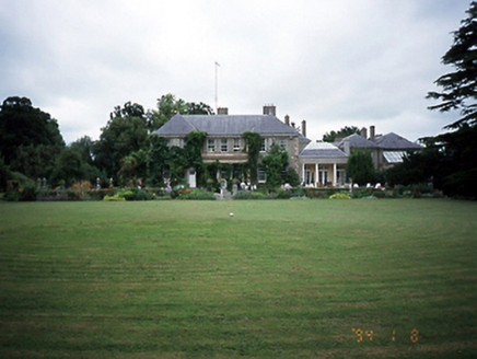 Brackenstown HouseCountry house · 446 ydThe JackoWood · 588 yd
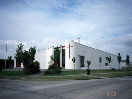 Saint Finian's Catholic ChurchChurch/chapel · 678 ydKim Archibold MemorialMemorial · 732 yd
 Glasmore Abbey (in ruins)Structure · 1059 yd
.jpg/250px-Belfry_and_round_tower_at_St._Columba's_Church_in_Swords,_Dublin_-148780_(40055235303).jpg "Photo: William Murphy from Dublin, Ireland, Wikimedia Commons · CC BY-SA 2.0") Round Tower1738 yd
Round Tower1738 yd.jpg/250px-Round_tower_at_St._Columba's_Church_in_Swords,_Dublin_-148782_(33144575398).jpg "Photo: William Murphy from Dublin, Ireland, Wikimedia Commons · CC BY-SA 2.0") Swords Round TowerHeritage attraction · 1740 yd
Swords Round TowerHeritage attraction · 1740 yd St Colmcilles WellVisitor information · 1.1 mi
 Airside Retail ParkVisitor information · 1.1 mi
 Tower (in ruins), Castle and ChapelCastle, Anglo-Norman masonry castle · 1.2 mi
_-_panoramio_(11).jpg/250px-Swords_Castle_(Near_Dublin_Airport)_-_panoramio_(11).jpg "Photo: William Murphy, Wikimedia Commons · CC BY-SA 3.0") Swords CastleCastle · 1.2 mi
Swords CastleCastle · 1.2 mi Dunsink ObservatoryHeritage attraction · 6.0 mi
Pictures: National Inventory of Architectural Heritage; Cg.wiki, Wikimedia Commons · CC BY-SA 4.0; William Murphy from Dublin, Ireland, Wikimedia Commons · CC BY-SA 2.0; A.-K. D., Wikimedia Commons · CC BY-SA 4.0; Darrin Antrobus, Geograph · CC BY-SA 2.0; BaronNethercross, Wikimedia Commons · CC BY-SA 4.0; William Murphy, Wikimedia Commons · CC BY-SA 3.0; JP, Wikimedia Commons · CC BY-SA 2.0
More archaeology and monuments in County Dublin · All of County Dublin
What do you know about this place?