What is recorded here
Situated on a S-facing slope. A circular enclosure is depicted lightly on the 1835 edition of the OS 6-inch map and it is visible as a circular feature on aerial photographs (OSAP 4/1028-9). This is a grass-covered circular platform (int. diam. 27m E-W; 25.6m N-S) defined by an eroded earthen bank best preserved at E: (Wth of base 10m; int. H 0.3m; ext. H 0.6m) and with an entrance at E. The W edge is incorporated into the townland boundary with Treanmore. Moore (Dublin: Stationery Office, 2003).
Situated on a S-facing slope. A circular enclosure is depicted lightly on the 1835 edition of the OS 6-inch map and it is visible as a circular feature on aerial photographs (OSAP 4/1028-9). This is a grass-covered circular platform (int. diam. 27m E-W; 25.6m N-S) defined by an eroded earthen bank best preserved at E: (Wth of base 10m; int. H 0.3m; ext. H 0.6m) and with an entrance at E. The W edge is…
From the National Monuments Service (Archaeological Survey of Ireland) record LE032-089
The monument record does not grant public access. Check the route and ask the landowner before entering private land.
- What survives
- Recorded monument
Places near here
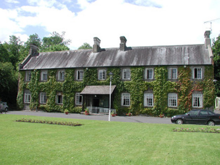 Ashbrook HouseHospital/infirmary · 597 yd
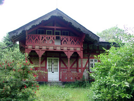 Swiss CottageCottage ornee · 667 ydChurch on site of AbbeyChurch · 1032 ydTurlough O'Carolan MonumentHeritage attraction · 1081 ydindicatedBawn · 1239 ydTober RonanHoly well · 1690 ydGiant's GraveArchaeological place · 1.4 miLittle IslandIslet · 1.5 mi
 Lawson's Cypress1.5 mi
 Tuliptree1.5 mi
 Lough Rynn HouseCastle · 1.6 mi
 Cavan & Leitrim RailwayMuseum · 4.2 mi
Pictures: National Inventory of Architectural Heritage; jonleebotany, Wikimedia Commons · CC0; Jean-Pol GRANDMONT, Wikimedia Commons · CC BY 3.0; SE Keenan, Wikimedia Commons · CC BY-SA 4.0; Reading Tom, Wikimedia Commons · CC BY 2.0
More archaeology and monuments in County Leitrim · All of County Leitrim
What do you know about this place?