What is recorded here
From the National Monuments Service (Archaeological Survey of Ireland) record KD040-021
Places near here
Photo credits
- Maker not stated on source page, commons.wikimedia.org
- Maker not stated on source page, en.wikipedia.org
- Maker not stated on source page, www.dreamstime.com
- National Inventory of Architectural Heritage
- liam murphy, Geograph · CC BY-SA 2.0
- Andrewmc, Wikimedia Commons · CC0
- Maker not stated on source page, cz.pinterest.com
- Andreas F. Borchert, Wikimedia Commons · CC BY-SA 4.0
- Maker not stated on source page, www.pinterest.com
 Mapped graveyardGraveyard · 932 yd
Explorer Tom Look closely at the stones in this mapped graveyard in Kildare; they are spelling out a hidden message about bad…
 St. Michaels Church (Site of)Church · 934 yd
Explorer Tom St. Michaels Church in Prumpelstown Lower is basically foundations now, but the sheep have strong opinions on its…
 Graveyard in Prumpelstown LowerGraveyard · 940 yd
Explorer Tom Prumpelstown Lower is prouder of its little font base than most people are of their first cars. It’s got a church…
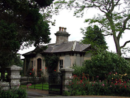 Prumplestown HouseGate lodge · 1257 yd
Explorer Tom Prumplestown House has a gate lodge fancier than the main house, which is rude. The first owner’s escape plan involved…
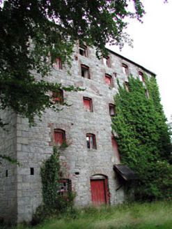 Prumplestown MillMill (water) · 1364 yd
Explorer Tom Prumplestown Mill in Johnstown South holds a fake world record for the number of grains of dust it has accumulated…
 water pump1385 yd
Explorer Tom Water pump in Woodlands West would post an Instagram story of itself looking artsy and neglected. It survived when…
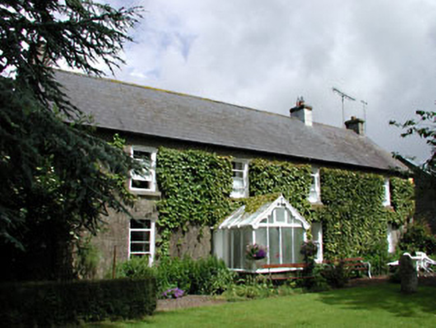 Woodlands HouseFarm house · 1.1 mi
Explorer Tom Woodlands House must have taken three million cups of tea just to build those carved bargeboards. It looks like it’s…
 Coltstown CemeteryCemetery · 1.3 mi
Explorer Tom Coltstown Cemetery is incredibly proud of its one perfect, unbroken hedge row that it has maintained for decades…
 Doyle's BridgeBridge · 1.3 mi
Explorer Tom Doyle's Bridge is suspicious of the postman because he dropped a letter on its nose last week. It’s arching its back to…
 CastleCastle, unclassified · 1.4 mi
Explorer Tom Castledermot’s missing castle thinks the road leading to it is a bit of a lazy shortcut, frankly speaking. It’s judging…
 TombTomb, hogback · 1.5 mi
Explorer Tom Tomb in Castledermot is a hogback, which means it’s the only one of its kind in Ireland, making it incredibly smug…
 19: Giants of the ForestVisitor information · 2.6 mi
Explorer Tom 19: Giants of the Forest in County Kildare carries a curse that only affects people who refuse to wave hello. You’ll…
More archaeology and monuments in County Kildare · All of County Kildare

What do you know about this place?Tap to add a comment or ask a question