What is recorded here
Situated N of the Nenagh River on a slight S-facing slope in pasture on formerly quite wet ground. A circular area (diam. 25.6m N-S; 27.6m E-W) defined by a scarp (H 0.64m), a fosse (Wth 4m; D 0.4m), a bank (Wth 3.6m; ext. H 0.4m), a fosse (Wth 3.7m; D 1.17m), a bank (Wth 4.8m; ext. H c. 1.2m) and an external fosse…
Read the whole record
Situated N of the Nenagh River on a slight S-facing slope in pasture on formerly quite wet ground. A circular area (diam. 25.6m N-S; 27.6m E-W) defined by a scarp (H 0.64m), a fosse (Wth 4m; D 0.4m), a bank (Wth 3.6m; ext. H 0.4m), a fosse (Wth 3.7m; D 1.17m), a bank (Wth 4.8m; ext. H c. 1.2m) and an external fosse (Wth 6m; ext. H 0.17m). Gaps occur in the NW and SE quadrants. The external face of the outer bank has been recently truncated while clearing vegetation. The site was excavated over two seasons in 1990 and 1991 (O'Sullivan 1991, 50-51; O'Sullivan 1992, 42). This investigation showed that the site was originally univallate consisting of a bank and external fosse. This bank was subsequently thrown into the fosse and new ramparts, consisting of a bank, fosse, outer bank and outer fosse, were constructed outside the original fosse. The NW entrance had a layer of cobbling which overlaid the original fosse fill. No internal structures came to light and finds consisted of two iron knives, two whetstones and bone fragments bearing decorative Early Christian patterns associated with the later phase of activity on the site. Vol. 1 - North Tipperary' compiled by Jean Farrelly and Caimin O'Brien (Dublin: Stationery Office, 2002).
From the National Monuments Service (Archaeological Survey of Ireland) record TN027-007
Places near here
Photo credits
- National Inventory of Architectural Heritage
- Miguel Angel Masegosa Martínez, Wikimedia Commons · CC BY 2.0
- David P Howard, Geograph · Creative Commons Attribution-ShareAlike 2.0
- P L Chadwick, Geograph · Creative Commons Attribution-ShareAlike 2.0
- Colin Park, Geograph · CC BY-SA 2.0
- Gramscis cousin at English Wikipedia, Wikimedia Commons · CC BY-SA 3.0
- Jonjobaker, Wikimedia Commons · CC BY-SA 4.0
- Sarah777, Wikimedia Commons · Public domain
 The Old RectoryRectory/glebe/vicarage/curate's house · 917 yd
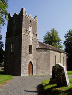 Ballynaclogh ChurchChurch/chapel · 1578 yd
 Gibbet HillMountain / peak · 1.3 miKillavalla WoodForest · 3.2 mi
 Sweet Chestnut3.4 mi
 Church (in Ruins)Graveyard · 3.7 mi
 Kilmore Church (in Ruins), GraveyardGraveyard · 3.8 mi
 CastleCastle, Anglo-Norman masonry castle · 3.9 mi
 Nenagh CastleCastle · 3.9 mi
 Nenagh Heritage CentreMuseum · 4.0 mi
 Silvermines ViewpointViewpoint · 4.4 mi
 Keeper HillMountain / peak · 6.8 mi
More archaeology and monuments in County Tipperary · All of County Tipperary
What do you know about this place?Tap to add a comment or ask a question