
Places near here
Photo credits
- Martin Kerans, Geograph · CC BY-SA 2.0
- National Inventory of Architectural Heritage
- Mike Searle, Wikimedia Commons · CC BY-SA 2.0
- Mike Searle, Geograph · CC BY-SA 2.0
- dougf, Wikimedia Commons · CC BY-SA 2.0
- Didier Descouens, Wikimedia Commons · CC BY-SA 4.0
- Willow, Wikimedia Commons · CC BY 2.5
- Rryswny, Wikimedia Commons · CC BY-SA 4.0
- John M, Geograph · CC BY-SA 2.0
- Humphrey Bolton, Geograph · CC BY-SA 2.0
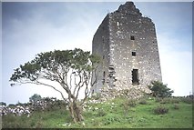 Cregg Castle (in ruins)Castle, tower house · 1066 yd
Explorer Tom Cregg Castle in Lakyle is a ghost town that forgot to send out the eviction notice. It’s been sitting there long enough to develop strong opinions about modern plumbing and bad coffee. Ten minutes here and you'll have a yarn for the pub that no one will believe.
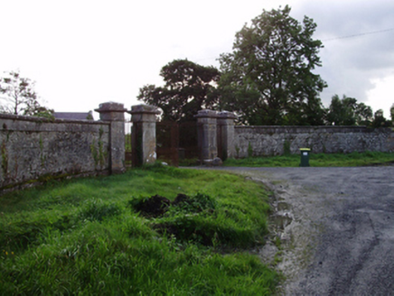 RoxboroughGates/railings/walls · 1313 yd
Explorer Tom Roxborough gates would say in a job interview that they have great references from Lady Gregory. They’re standing guard over a burnt-down house, looking professional despite the chaos behind them. Great spot to propose if you like drama.
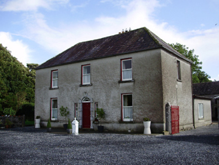 Carheen HouseHouse · 1578 yd
Explorer Tom Carheen House is being picked on by the wind because its chimneystack bends back like a weird question mark. The carved doorcase tries to keep up with the grandeur. Stick around for the light, it’s dramatic here.
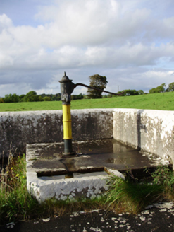 water pump1.3 mi
Explorer Tom Water pump in Ballygarraun makes a weird clinking sound at night that nobody can explain. It thinks it’s elegant with its fluted neck, but honestly, it looks like a fancy bottle opener. Go on, count the windows and yawn.
 Designed landscapeDesigned landscape, folly · 2.1 mi
Explorer Tom Designed landscape in Castleboy is a folly, which means it’s expensive nonsense. I swear there’s a curse on anyone who doesn’t wave at it while passing. Visit, then text me what you think. I'll pretend to read it.
 Strongfort Castle (in ruins)Castle, tower house · 3.6 mi
Explorer Tom Strongfort Castle was refurbished in the 1980s with concrete floors, so it’s now basically a modern flat with medieval pretensions. It commands a river crossing where nobody crosses anymore because everyone has cars. Ideal stop for a big stretch and a bigger yawn at the crenellations.
 Round Tower (in ruins)Round tower · 4.5 mi
Explorer Tom Round Tower in Ardrahan North has been reduced to a few courses of limestone hidden under cemetery ground. Nobody knows where the top went, so I’m guessing it got promoted to heaven. Bring a pen pal, they’ll be jealous of its mystery.
 Hawthorn5.9 mi
Explorer Tom Hawthorn in County Galway is in a serious rivalry with a more famous oak down the road, mostly over who has the better fruit. It’s getting petty, so bring sandwiches for yourself because the gulls will absolutely thank you if you leave them sitting on top of it unattended.
 European ash6.0 mi
Explorer Tom European ash started as a bet between two lads in the pub who couldn't agree on which tree looked more imposing at dusk. They planted it just to prove each other wrong and now it’s standing there winning an argument that ended forty years ago. It's the kind of place that makes a dull Tuesday interesting.
 Drumacoo Monastic SiteHeritage attraction · 8.5 mi
Explorer Tom Drumacoo Monastic Site is complaining to the council that the tourists keep leaving their sandwiches on the grass and it’s getting a bit tired of all the mess. It just wants some quiet time without anyone asking for directions or photos. Tell the kids it's a castle. Close enough.
 Kilmacduagh Monastic SiteVisitor information · 12 mi
Explorer Tom Kilmacduagh Monastic Site thinks Dublin tourists are basically overgrown children who need a stern lecture about history and manners. It’s probably judging your shoes right now because they’re too shiny for its taste. It's free, it's odd, what more do you want?
 Kilmacduagh MonasteryHeritage attraction · 12 mi
Explorer Tom Kilmacduagh gives you a round tower and a name that has outlived several different churches. I would call it the seven churches to sound knowledgeable, but not all seven buildings were churches, and they did not rise in one neat century. Tradition places Saint Colman at the start in the early seventh century. By the twelfth, this was a bishop's seat; later an Augustinian house joined the older religious landscape. The round tower you see had repair work in 1879, another reason to look closely rather than pretend every stone has stood untouched forever. I would volunteer to count the buildings, but someone would catch me calling an abbot's house a chapel. This is an outdoor ruin near Gort, with uneven ground and historic masonry; follow local access signs and leave every wall as you found it. Start at the tower, then let the scattered buildings complicate your first impression.
More archaeology and monuments in County Galway · All of County Galway

What do you know about this place?Tap to add a comment or ask a question