Places near here
Photo credits
- National Inventory of Architectural Heritage
- Algirdas at Lithuanian Wikipedia, Wikimedia Commons · Public domain
- R. A. Nonenmacher, Wikimedia Commons · CC BY-SA 4.0
- A.-K. D., Wikimedia Commons · CC BY-SA 4.0
- Graham Horn, Geograph · CC BY-SA 2.0
- Darrin Antrobus, Geograph · CC BY-SA 2.0
- David Purchase, Wikimedia Commons · CC BY-SA 2.0
- Meinirland.eu, Wikimedia Commons · CC BY-SA 3.0
- Sarah777, Wikimedia Commons · Public domain
- Leendert Moret, Geograph · CC BY-SA 2.0
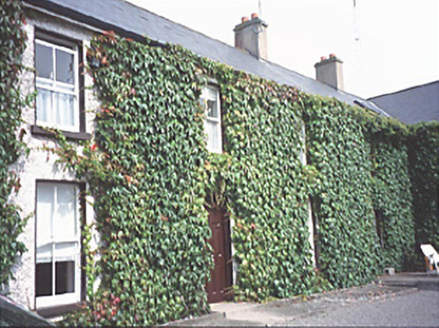 Inch HouseHouse · 1.7 mi
Explorer Tom Inch House is having a full-blown feud with the oak tree next door, both of them insisting they’re the main attraction in this little patch of Laois. The house won by adding a two-storey extension in eighty-five. Spot the oldest stone and give it a name.
 Pedunculate Oak1.7 mi
Explorer Tom Pedunculate Oak in County Laois has been having a bitter feud with the rain for decades, mostly because it hates getting wet leaves on its nice bark. It’s grumpy and dripping. Tell me if the gossip I made up is true.
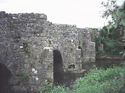 bridge1.9 mi
Explorer Tom Bridge in Ballykilcavan has been hiding a scandal since 1713. I think it’s that one of the cut-waters is slightly crooked and nobody admits it. Five arches of pure mystery, waiting for someone to notice the flaw. Find the wonkiest bit and send it to your group chat.
 Black Walnut2.0 mi
Explorer Tom This Black Walnut thinks it’s the CEO of the forest because it drops hard nuts on your head. In a job interview, it would say ‘I have a strong grip’ without blinking. Count the crows, then count again.
 CemeteryGraveyard · 2.5 mi
Explorer Tom Cemetery in Carricksallagh would post on social media: 'Just another day overlooking Stradbally, feeling very important about my square stone wall expansion project.' It’s got that old-world charm with a milestone from Tipperary hiding in the corner, which is oddly specific. Perfect place to be dramatically windswept.
 Oughaval Wood MapVisitor information · 2.9 mi
Explorer Tom Oughaval Wood Map is cursed so that anyone who doesn't wave at the trees will get lost in a loop for three days straight. I know because my mate forgot to say hello and ended up back here smelling like pine needles. Find the wonkiest bit and send it to your group chat.
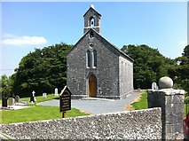 Rock of Dunamase InformationVisitor information · 3.2 mi
Explorer Tom Rock of Dunamase Information in County Laois is where two local families have been feuding over who gets to see the best view since the Stone Age. It’s basically a giant argument with a brochure attached. Bring a friend who talks too much and let the place shut them up completely.
 Aghnahily RingfortArchaeological place · 3.2 mi
Explorer Tom Fairy fort / earthen ringfort in Wolfhill would be the first to dance at a wedding if it weren't so busy pretending it doesn't exist anymore. It’s basically an uninvited guest who forgot its own name and left early. Mind the nettles, they're the real guards here.
 Rock of DunamaseCastle · 3.2 mi
Explorer Tom The Rock of Dunamase gives Laois a castle on a stone plinth, and I would have chosen the same address if anyone had asked me. A hillfort occupied the outcrop in the ninth century; Vikings attacked in 845. Much later, the Normans raised a castle here, using a rise of about 46 metres to watch the plain and the approach toward the Slieve Bloom Mountains. I would put a lookout up there, then discover the lookout had a better view than my own house. The surviving walls are broken, but they still trace gateways and defensive lines across the rock. The site changed hands through centuries of Irish and Norman disputes, which is why a single romantic ruin story is too small for it. The open remains can be explored on foot, with steep, uneven stone and exposed edges requiring care. Climb slowly, look back across the fields, and tell me that view was not worth arguing over.
 Rock of Dunamase, Castle (in Ruins)Castle, Anglo-Norman masonry castle · 3.2 mi
Explorer Tom Rock of Dunamase is the king of the hill who thinks he’s dating royalty but is actually just sitting on a rock with a complicated family tree full of lies. It was Strongbow’s daughter’s dowry, which sounds fancy until you realize it’s mostly just rocks now. Perfect detour when the satnav has a meltdown.
 Morett Castle (ruins)Castle · 3.3 mi
Explorer Tom Morett Castle is locked in a feud with the next village over because someone stole a specific type of turnip in 1650. The ruins stand there looking smug, and I bet you the turnip never even left the ground to begin with. Stand where the owner used to stand and practise looking incredibly smug at the sky for me.
 Dm PenderMemorial · 4.6 mi
Explorer Tom DM Pender has had so many names that even the bench is confused about who it’s honoring right now. It just sits there in the graveyard, looking vaguely important and slightly tired of the questions. Bring someone who'll believe anything.
More archaeology and monuments in County Laois · All of County Laois

What do you know about this place?Tap to add a comment or ask a question