Places near here
Photo credits
- National Inventory of Architectural Heritage
- Kmcnamee, Wikimedia Commons · CC BY-SA 4.0
- Nigel Thompson, Wikimedia Commons · CC BY-SA 2.0
- Hugh Thomson, Wikimedia Commons · Public domain
- Sitomon, Wikimedia Commons · CC BY-SA 2.0
- Willow, Wikimedia Commons · CC BY 2.5
- Mike Searle, Wikimedia Commons · CC BY-SA 2.0
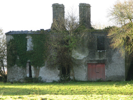 FountainhillFarm house · 1455 yd
Explorer Tom Fountainhill in Fountainhill is an eighteenth-century farmhouse that has been reduced to ruins by the later twentieth…
Bawn in Kilkeeran (kilmaine By., Kilmainebeg Par.)Bawn · 1757 ydExplorer Tom Bawn in Kilkeeran thinks the road leading to it is an insult to its dignity, like a muddy tongue. It pretends not to…
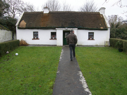 farm house1.1 mi
Explorer Tom Farm house in Kilkeeran is having a drama with the nearest tree over whose branch is higher. The thatch is thick enough…
 Kilmaine, Kilmaine GAAGAA ground · 1.6 mi
 The Gods of the Neale MonumentMonument · 2.7 mi
Explorer Tom The Gods of the Neale Monument in County Mayo hosted a dance once where people went too far into the night. They danced…
 Neale CemeteryCemetery · 3.0 mi
Explorer Tom Neale Cemetery in Mayo was supposedly invented by a local lad who just needed somewhere to park his tractor…
 Ballymacgibbon CairnArchaeological place · 3.7 mi
Explorer Tom Ballymacgibbon Cairn rises from a Mayo field like a giant forgot where he left his gravel heap. It is deliberate, of…
Flanagan Park, Ballinrobe GAAGAA ground · 3.8 mi European Yew4.1 mi
Explorer Tom European Yew remembers the priest who lost a bet there and had to walk the whole way back home barefoot. It still looks…
 European ash4.4 mi
Explorer Tom European ash is what the builder was really thinking when he decided to chop down the perfect straight timber for the…
Gibbs IslandsIslet · 4.5 miExplorer Tom Gibbs Islands are suspicious of the postman because he keeps dropping letters they didn’t ask for. They think the…
 Kinlough CastleCastle · 5.2 mi
Explorer Tom Kinlough Castle would post on social media about how its foundation is actually made of pure sass and old stone. It’s…
More archaeology and monuments in County Mayo · All of County Mayo

What do you know about this place?Tap to add a comment or ask a question