
Places near here
Photo credits
- National Inventory of Architectural Heritage
- Created by Kglavin Modified Aug 2007 by Mike Christie, Wikimedia Commons · CC BY-SA 3.0
- dougf, Geograph · CC BY-SA 2.0
- Willow, Wikimedia Commons · CC BY 2.5
- Vadim Manuylov, Wikimedia Commons · CC BY-SA 3.0
- A.-K. D., Wikimedia Commons · CC BY-SA 4.0
Explorer Tom This Mound in Knockbweeheen has a curse that only hits if you don’t wave at it first. It’s levelled now, but the spirit lives on in your head. Stand still and listen, the wind tells it better than me.
 Saint Colman's Catholic ChurchChurch/chapel · 1481 yd
Explorer Tom Saint Colman’s Catholic Church in Kilcolman thinks the concrete shortcut is the long way round, but hey, it’s pretty. The texture is rougher than my morning face, which says something. Perfect place to be dropped off and left alone for a bit.
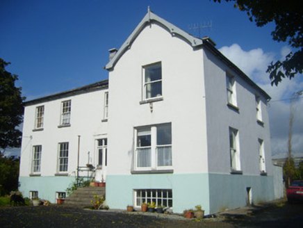 Rathronan HouseRectory/glebe/vicarage/curate's house · 1.1 mi
 Ballyegny HouseHouse · 1.1 mi
Explorer Tom Ballyegny House has a secret talent: it can balance a teacup on its chimney stack without spilling. The symmetrical façade is perfect for this kind of precision engineering. Stand where the owner stood and practis your own balancing act.
 Rathgoonan HouseCountry house · 1.1 mi
Explorer Tom Rathgoonan House in Rathgoonan has a secret talent for looking smug while hiding behind its Victorian stone walls. It was built by someone who really thought they were special, which shows. Get there early and have it all to yourself.
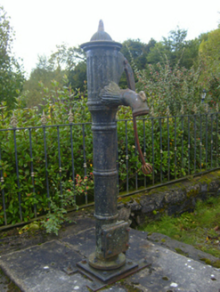 water pump1.2 mi
 Ardagh FortArchaeological place · 2.1 mi
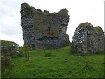 CastleCastle, motte and bailey · 2.7 mi
Explorer Tom Castle in Shanid Upper is having a feud with its neighbour over something daft, probably a fence line. It’s sitting on a hill like a grumpy old king. It's the kind of place that makes a dull Tuesday interesting.
Shanid CastleCastle · 2.7 mi European ash5.4 mi
Explorer Tom European ash makes a creaking sound at night that sounds exactly like someone judging your life choices. It’s just a tree, but it acts like it has a podcast. Take a breath of that air, it's older than your car.
 Monterey Cypress6.5 mi
Explorer Tom Monterey Cypress in County Limerick is deeply suspicious of the postman, thinking he's spying on its private moments. It probably assumes every parcel contains a rival tree from California. Take the long way round, it deserves the effort.
 Saint Ite's WellSpring · 9.8 mi
More archaeology and monuments in County Limerick · All of County Limerick

What do you know about this place?Tap to add a comment or ask a question