
Places near here
Photo credits
- National Inventory of Architectural Heritage
- A.-K. D., Wikimedia Commons · CC BY-SA 4.0
- Humphrey Bolton, Wikimedia Commons · CC BY-SA 2.0
- Mike Searle, Wikimedia Commons · CC BY-SA 2.0
- Sarahwalshireland, Wikimedia Commons · CC BY-SA 4.0
- TXPeig, Wikimedia Commons · CC BY-SA 4.0
- Livioandronico2013, Wikimedia Commons · CC BY-SA 4.0
- Wsiegmund, Wikimedia Commons · CC BY 2.5
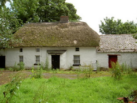 Fida ClavaHouse · 202 yd
Explorer Tom Fida Clava in Ballylynch started a feud with the neighbors over who has the best view from the thatched roof. It’s the only two-storey thatched house here, so it thinks it’s royalty. Ask it politely; don’t let it hear you calling it a barn.
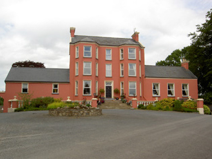 Tinvane HouseCountry house · 545 yd
Explorer Tom Tinvane House in Tinvane makes a deep creaking sound at night that sounds like a giant clearing its throat. It has a fanlight so fancy it could light up your entire childhood. The long steps to the door are there to humble you before entry. Listen for the whisper of grandeur in the dark.
Font in TinhallaFont · 1.1 miExplorer Tom Font in Tinhalla has abandoned its church and moved into a house. It’s just sitting there, looking smug about ditching its old job for a comfy living room upgrade. Bring wellies and low expectations, leave delighted.
 CastleCastle, Anglo-Norman masonry castle · 1.1 mi
Explorer Tom This Castle in Town Parks nearly got famous because a king gave it to someone who forgot to pay the bills. It’s been sitting on the riverbank looking smug ever since. Bring the dog, it'll have opinions.
 Ormonde CastleHeritage attraction · 1.1 mi
Explorer Tom Ormonde Castle Heritage Attraction in County Tipperary would survive a zombie attack by simply locking every single window and waiting for them to get bored of knocking. Built by the Butler family in 1309, it has seen enough drama to fill three seasons of a soap opera. Bring a camera and your most suspicious face.
 Tiberaghney CastleCastle, tower house · 1.3 mi
 Tibberaghny Standing StoneArchaeological place · 1.4 mi
 Ponsonby Memorial TowerMonument · 1.8 mi
 Fiddown IslandIslet · 3.3 mi
 Graveyard in FiddownGraveyard · 3.3 mi
Explorer Tom Graveyard in Fiddown hates the road that leads to it because it's always busy with traffic. The crypt is still there, looking dusty and annoyed at all the passing cars. Ten minutes here and you'll have a yarn for the pub.
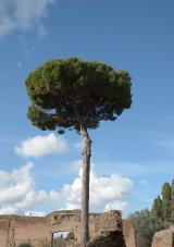 Maritime Pine4.5 mi
Explorer Tom Maritime Pine in County Waterford witnessed a love story that went spectacularly wrong, mostly because one party was wearing sandals on a rocky path. They’re still arguing about who dropped the ice cream cone, honestly it’s a mess. Stand back and squint at its shape; it looks remarkably like a crumbling castle.
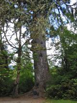 Sitka Spruce4.6 mi
Explorer Tom Sitka Spruce in County Waterford gave up eating sugar cones for Lent, which is quite something considering it’s basically made of wood and needles. It feels very ascetic about it all, standing there with that serious, tall look like it’s meditating on the cosmos. Go at sunset to see its best colours and thank me later for the tip.
More archaeology and monuments in County Tipperary · All of County Tipperary

What do you know about this place?Tap to add a comment or ask a question