What is recorded here
On a prominent hillock in otherwise lowlying terrain. A circular bawn (LF018-060002-) (diam. 39.9m) is defined by the foundations of a stone wall (T 2.1m). Given its siting, size and shape, it is likely that it is an adaptation of a pre-existing ringfort, with the circuit of the bawn wall mirroring that of the ringfort’s enclosing element. No visible surface trace of the ringfort survives. A tower house (LF018-060001-) is centrally located within the bawn. O'Donovan
Date of upload: 13 December 2011
On a prominent hillock in otherwise lowlying terrain. A circular bawn (LF018-060002-) (diam. 39.9m) is defined by the foundations of a stone wall (T 2.1m). Given its siting, size and shape, it is likely that it is an adaptation of a pre-existing ringfort, with the circuit of the bawn wall mirroring that of the ringfort’s enclosing element. No visible surface trace of the ringfort survives. A tower house…
From the National Monuments Service (Archaeological Survey of Ireland) record LF018-060003
The monument record does not grant public access. Check the route and ask the landowner before entering private land.
- What survives
- Recorded monument
Places near here
Photo credits
- National Inventory of Architectural Heritage
- Royalcanalrunner, Wikimedia Commons · CC BY-SA 4.0
- Sheila1988, Wikimedia Commons · CC BY-SA 4.0
- Mike Searle, Geograph · CC BY-SA 2.0
- Kieran Campbell, Geograph · CC BY-SA 2.0
- David Baird, Geograph · CC BY-SA 2.0
- Sailko, Wikimedia Commons · CC BY 3.0
- David Baird, Wikimedia Commons · CC BY-SA 2.0
- Arno-nl, Wikimedia Commons · CC BY-SA 4.0
- Christopher Hilton, Wikimedia Commons · CC BY-SA 2.0
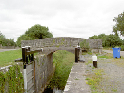 Coolnahinch BridgeBridge · 982 yd
 41st LockLock · 1001 ydCorlea Bog Walk Blue LoopWalking route · 1.8 mi
 Corlea Trackway Interpretative CentreHeritage attraction · 1.9 mi
 Rathcline CastleHouse, fortified house · 7.0 mi
 Rathcline CastleBawn · 7.0 mi
 Leveret IslandIslet · 7.2 mi
 Ecclesiastical enclosure in InchbofinEcclesiastical enclosure · 7.6 mi
 InchbofinIslet · 7.9 mi
 Safe HarbourBay · 9.5 mi
 Historic town in Warren,rinnaganHistoric town · 9.5 mi
 RindoonWood · 9.6 mi
More archaeology and monuments in County Longford · All of County Longford
What do you know about this place?