What is recorded here
In tillage, on plateau, with view in all directions. Roughly circular area (108m E-W; 96m N-S) enclosed by drystone wall SE->NNW and by scarp (H 3.6m) NNW->SE. Bank overgrown with bushes. Interior level; several pieces of iron slag recovered during site inspection. Known locally as 'Ard na Killeen'. Ringfort (12109) c. 90m to E. Surrounding field boundaries built of stone.
From the National Monuments Service (Archaeological Survey of Ireland) record CO018-032
The monument record does not grant public access. Check the route and ask the landowner before entering private land.
- What survives
- Recorded monument
Places near here
Mary Frasier'sArchaeological place · 687 yd Farahy SchoolSchool · 824 ydBowen's CourtGates/railings/walls · 1248 ydFarahy Castle (in Ruins)Castle, unclassified · 1703 ydWallstown CastleCastle · 2.2 miFlat cemetery in Ballyenahan NorthFlat cemetery · 3.0 miCarrigeenamronetyMountain / peak · 3.7 miPedunculate Oak4.5 miDoneraile CourtFoot bridge · 4.5 miDoneraile CourtBridge · 4.7 miGrave YardGraveyard · 4.7 miEuropean Yew4.8 mi
 Farahy SchoolSchool · 824 yd
 Bowen's CourtGates/railings/walls · 1248 ydFarahy Castle (in Ruins)Castle, unclassified · 1703 yd
 Wallstown CastleCastle · 2.2 miFlat cemetery in Ballyenahan NorthFlat cemetery · 3.0 mi
 CarrigeenamronetyMountain / peak · 3.7 mi
 Pedunculate Oak4.5 mi
 Doneraile CourtFoot bridge · 4.5 mi
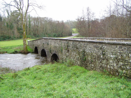 Doneraile CourtBridge · 4.7 mi
 Grave YardGraveyard · 4.7 mi
 European Yew4.8 mi
Pictures: National Inventory of Architectural Heritage; Mike Searle, Geograph · CC BY-SA 2.0; CaitNi, Wikimedia Commons · CC BY-SA 4.0; Algirdas at Lithuanian Wikipedia, Wikimedia Commons · Public domain; john salter, Geograph · Creative Commons Attribution-ShareAlike 2.0; Sitomon, Wikimedia Commons · CC BY-SA 2.0
More archaeology and monuments in County Cork · All of County Cork
What do you know about this place?