What is recorded here
Located on a slight E-facing slope. This is a D-shaped grass and scrub-covered area (dims 40m NW-SE; 32m NE-SW) defined by an earthen bank and hedge best preserved (Wth 4.5-5.5m; int. H 0.6-1m; ext. H 1.2-1.5m) S-N and reduced to a scarp (H 1m) E-S. The monument is truncated by a NW-SE field bank at NE. There is an entrance (Wth 3m) at S, but there is no visible fosse. Archaeological monitoring (15E0412) of a gas pipeline c. 30m to the N in Area 7 produced no related material (Sutton 2018; excavations.ie 2015:422).
Located on a slight E-facing slope. This is a D-shaped grass and scrub-covered area (dims 40m NW-SE; 32m NE-SW) defined by an earthen bank and hedge best preserved (Wth 4.5-5.5m; int. H 0.6-1m; ext. H 1.2-1.5m) S-N and reduced to a scarp (H 1m) E-S. The monument is truncated by a NW-SE field bank at NE. There is an entrance (Wth 3m) at S, but there is no visible fosse. Archaeological monitoring (15E0412) of a gas…
From the National Monuments Service (Archaeological Survey of Ireland) record WX040-068
The monument record does not grant public access. Check the route and ask the landowner before entering private land.
- What survives
- Recorded monument
Places near here
Photo credits
- National Inventory of Architectural Heritage
- Mike Searle, Wikimedia Commons · CC BY-SA 2.0
- David Purchase, Wikimedia Commons · CC BY-SA 2.0
- Colin Park, Geograph · CC BY-SA 2.0
- seegraswiese, Wikimedia Commons · CC BY-SA 3.0
- Richard Webb, Geograph · CC BY-SA 2.0
- Julie Anne Workman, Wikimedia Commons · CC BY-SA 3.0
- Humphrey Bolton, Geograph · CC BY-SA 2.0
 Ballygarvan HouseFarm house · 391 ydLadys WellHoly well · 939 yd
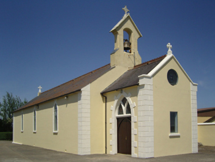 Catholic Church of Saint John the BaptistChurch/chapel · 1018 ydEMbanked enclosureFairy fort / earthen ringfort · 1134 yd
 Rathumney Castle (in ruins)Castle, hall-house · 1.6 mi
_-_geograph.org.uk_-_7608906.jpg/250px-Castles_of_Leinster,_Tellarought,_Wexford_(1)_-_geograph.org.uk_-_7608906.jpg "Photo: Mike Searle, Wikimedia Commons · CC BY-SA 2.0") Castle (in ruins)Castle, tower house · 2.7 mi
Castle (in ruins)Castle, tower house · 2.7 mi SlievecoiltiaMountain / peak · 4.0 mi
 Campile WWII Bombing MemorialMemorial · 4.3 mi
 Devon whitebeam4.7 mi
 Carrickbyrne HillMountain / peak · 4.9 mi
 Common Whitebeam6.0 mi
 Arthurstown BeachBeach / strand · 6.5 mi
More archaeology and monuments in County Wexford · All of County Wexford
What do you know about this place?