
What is recorded here
From the National Monuments Service (Archaeological Survey of Ireland) record TS075-027002
Places near here
Photo credits
- National Inventory of Architectural Heritage
- Maker not stated on source page, www.tripadvisor.com.au
- Maker not stated on source page, www.thestandingstone.ie
- Martin Richard Phelan, Geograph · CC BY-SA 2.0
- Sarah777, transferred by Lvova, Wikimedia Commons · Public domain
- Maker not stated on source page, tr.pinterest.com
- Mike Searle, Wikimedia Commons · CC BY-SA 2.0
- Maker not stated on source page, www.alamy.com
- Andreas F. Borchert, Wikimedia Commons · CC BY-SA 4.0
- Chmouel Boudjnah Original uploader was Chmouel at fr.wikipedia, Wikimedia Commons · CC BY-SA 3.0
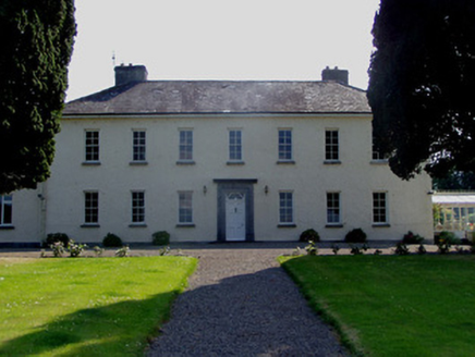 Ballydrehid HouseCountry house · 25 yd
Explorer Tom Ballydrehid House is proud of its limestone plinth because it thinks it’s holding up the whole world, which is a bit…
 CastleCastle, unclassified · 1081 yd
Explorer Tom Castle in Ballydrehid has a secret talent for disappearing into the fog just when you think you’ve found it. It’s…
 TombTomb, effigial · 1081 yd
Explorer Tom Tomb is a broken slab of drapery that vanished into thin air somewhere around 1945. Apparently, two lads made a bet in…
 Knockgraffon MoatCastle, motte and bailey · 1389 yd
Explorer Tom Knockgraffon Moat has a hidden treasure that is definitely just a biscuit tin from 1974. It was built in 1192, which…
 Knockgraffon MotteArchaeological place · 1400 yd
Explorer Tom Knockgraffon Motte is furious because the map makers got its position completely wrong on the last survey. They put it…
 Castle (in ruins)Castle, tower house · 1412 yd
Explorer Tom Castle in Knockgraffon has a New Year’s resolution to stop leaning so dramatically to the left. It’s a tower house…
 Ballydrehid National SchoolSchool · 1436 yd
Explorer Tom Ballydrehid National School in Ballydrehid, County Tipperary is sick of people asking if it still teaches cursive. It’s…
 Knockgraffon CastleCastle · 1.2 mi
Explorer Tom Knockgraffon Castle in County Tipperary has circular bartizans that look like they’re watching you with suspicion…
 Holy WellWayside shrine · 1.4 mi
Explorer Tom Holy Well in County Tipperary hosted a fake royal visit once where the queen’s hat blew off into the water and nobody…
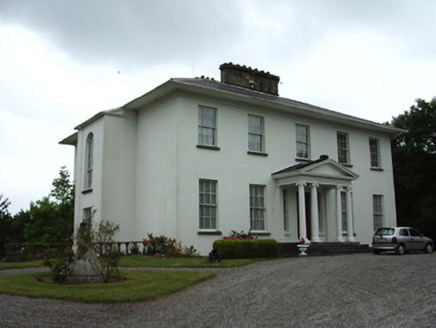 Cahir AbbeyHouse · 1.7 mi
Explorer Tom Cahir Abbey claims its family tree is mostly made up of classical proportions and pedimented porticos that peaked in…
 Caher AbbeyHeritage attraction · 1.9 mi
Explorer Tom Cahir Abbey stands in town as the ruined Priory of St Mary, its crossing tower determined to have the last word over…
 Siege of Cahir CastleSiege · 2.1 mi
Explorer Tom The Siege of Cahir Castle happened when someone got really angry about walls and probably ran out of bread. The name…
More archaeology and monuments in County Tipperary · All of County Tipperary

What do you know about this place?Tap to add a comment or ask a question