What is recorded here
Just below the crest at the N end of a ridge between two small N-S stream valleys with ground falling steeply to the N, E and W, mostly in grassland with a strip of woodland immediately to the E. The monument itself is quite overgrown with trees and scrub. There are very good views in all directions. Depicted on the 1st (1839) ed. OS 6-inch map as an oval enclosure (dims. c. 38m NW-SE to S field boundary; c. 35m NE-SW), the S sector is transected by a field boundary running roughly E-W and is not indicated S of the boundary. The enclosure is defined by a stoney, grass-covered bank (int. H c. 0.4m; ext. H c. 0.6m; overall Wth c. 3m). The interior slopes gently to the NE and there is a small quarry in the E quadrant.
Just below the crest at the N end of a ridge between two small N-S stream valleys with ground falling steeply to the N, E and W, mostly in grassland with a strip of woodland immediately to the E. The monument itself is quite overgrown with trees and scrub. There are very good views in all directions. Depicted on the 1st (1839) ed. OS 6-inch map as an oval enclosure (dims. c. 38m NW-SE to S field boundary; c. 35m…
From the National Monuments Service (Archaeological Survey of Ireland) record KK014-045
The monument record does not grant public access. Check the route and ask the landowner before entering private land.
- What survives
- Recorded monument
Places near here
Photo credits
- kevin higgins, Wikimedia Commons · CC BY-SA 2.0
- A.-K. D., Wikimedia Commons · CC BY-SA 4.0
- Maker named on the Wikimedia Commons picture page · CC BY-SA 3.0
- A.-K. D., Wikimedia Commons · CC0
- Rüdiger Wölk This photo was taken by Rüdiger Wölk . Please credit this photo Rüdiger Wölk, Münster . View all photos (large page) of Rüdiger Wölk I would also appreciate an email to rudiger.wolk@gmail.com with details of use. Für Hinweise auf Veröffentlichungen (rudiger.wolk@gmail.com) oder Belegexemplare bin ich Ihnen dankbar., Wikimedia Commons · CC BY-SA 2.5
- Humphrey Bolton, Geograph · CC BY-SA 2.0
 Saint Nicholas's Catholic ChurchChurch/chapel · 853 yd
 Church in KillareeChurch · 978 yd
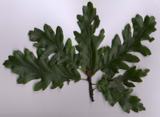 Turkey Oak1432 yd
 Graveyard in ThreecastlesGraveyard · 1592 yd
 Castle (in ruins)Castle, tower house · 1595 yd
 Castle (in Ruins)Castle, tower house · 2.4 mi
 ToberlaghteenHoly well · 3.2 mi
 Font in Freshford LotsFont · 3.4 mi
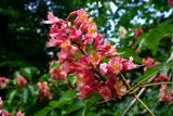 Red horse-chestnut3.5 mi
 Emma Jane Browne-ClaytonMemorial · 3.5 mi
 St. Mogarra’s WellSpring · 7.9 mi
 Tullaherin Church and Round TowerVisitor information · 12 mi
More archaeology and monuments in County Kilkenny · All of County Kilkenny
What do you know about this place?