Places near here
Photo credits
- John M, Geograph · CC BY-SA 2.0
- National Inventory of Architectural Heritage
- Michael Deligan, Wikimedia Commons · CC BY-SA 4.0
- Jason Keane, Geograph · CC BY-SA 2.0
- P L Chadwick, Wikimedia Commons · CC BY-SA 2.0
- Mike Searle, Geograph · CC BY-SA 2.0
- Sitomon, Wikimedia Commons · CC BY-SA 2.0
- Rasbak at Dutch Wikipedia, Wikimedia Commons · CC BY-SA 3.0
- P L Chadwick, Geograph · CC BY-SA 2.0
Explorer Tom Caves in Ballycorban were once run by a matchmaker who used the small tunnel for secret dates between the village bachelors. Now it’s blocked up, but I bet you can still hear them whispering about who stole whose horse. Find the date carved somewhere and feel clever.
 Saint Joseph's Catholic ChurchChurch/chapel · 506 yd
Explorer Tom Saint Joseph’s Catholic Church in Knockadrum nearly got famous when a famous politician accidentally parked his carriage on its lawn. The cut-stone frontispieces are fancy enough to make you feel small. Have a nosey, politely, and don’t touch the iron gates.
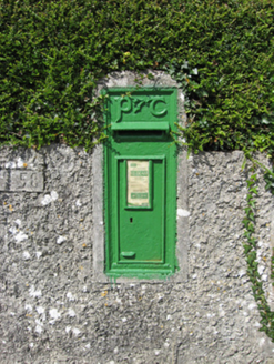 post box618 yd
Explorer Tom Post box in Clooneen is judging your handwriting from across the lane. Built for Irish Independence, it's still standing while your confidence crumbles. It hates tourists who just touch it without mailing anything. Ideal spot for a dramatic pho
 Pallas CastleCastle, tower house · 4.6 mi
Explorer Tom Pallas Castle has a ghost that’s too lazy to haunt it because the stairs are too steep. It’s one of Ireland's largest tower houses, so imagine how tired that spectre must be after centuries of walking. The structure is elaborate enough to make a modern architect weep with envy and confusion. Visit, then text me what you think. I'll pretend to read it.
 Friar's IslandIslet · 6.4 mi
Explorer Tom Friar's Island has a long-standing grudge with the weather; it thinks the clouds are just jealous of its solitude. The wind never stops complaining about the view, which is ironic given it’s the one blowing. Bring the dog, it'll have opinions.
 Gortaganna GraveyardGraveyard · 6.7 mi
Explorer Tom Gortaganna Graveyard in County Galway thinks modern houses are an affront to its dignity and ancient roots. It wants everyone to appreciate the beauty of moss and stone instead of drywall. Have a nosey, politely, so you don't offend it too much.
 Church IslandIslet · 8.7 mi
Explorer Tom Church Island has a ghost who is too lazy to haunt it properly because he’d have to walk all the way up the hill and back down again, which is exhausting. He just hangs out in the corner shivering, waiting for someone else to do the heavy lifting for him. Practise your Irish on it, it won't correct you.
 Drominagh CastleCastle · 9.0 mi
Explorer Tom Drominagh Castle once had a prophecy saying it would float away during a full moon, which has never happened yet. It’s still waiting, just in case, keeping one foot slightly off the ground. Bring your own legend, I've run out.
 European Yew9.6 mi
Explorer Tom The European Yew in County Galway is having a massive falling out with the nearest ash tree over who gets more sun. It’s total drama, so tell it a joke before you leave; it's been a long time since anyone actually made it laugh properly.
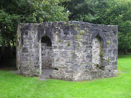 Portumna CastleGate lodge · 9.6 mi
Explorer Tom This gate lodge is hiding a scandal about who actually paid for the roof, and nobody wants to know. It looks fancy but it’s really just a very expensive doorman’s booth. Go on a wet day and enjoy the drama.
 Common Juniper9.6 mi
Explorer Tom Common Juniper is tough as old boots, shrugging off zombie attacks with a sneer and a few prickly needles to prove its point. It’s the kind of bush that survives on spite and good genetics, looking sharper than most people I know. Perfect place to be dramatically windswept.
 Lough DergNationally known place · 11 mi
Explorer Tom Lough Derg in County Tipperary has an imaginary fan club of ducks who refuse to leave because they like the view too much. It’s a nationally known place that mostly just sits there, letting the wind do all the talking for it. Pack a picnic and an excuse.
More archaeology and monuments in County Galway · All of County Galway

What do you know about this place?Tap to add a comment or ask a question