Places near here
Photo credits
- National Inventory of Architectural Heritage
- Richard Webb, Geograph · CC BY-SA 2.0
- Mike Searle, Wikimedia Commons · CC BY-SA 2.0
- Jonathan Thacker, Geograph · CC BY-SA 2.0
- Oliver Dixon, Geograph · CC BY-SA 2.0
Explorer Tom Enclosure in Ballyclemock has very strong opinions on modern buildings, mostly because they’re all straight lines and it’s a circle. It probably thinks every new house is an insult to the concept of roundness and dignity. Bring a coin for luck and keep it in your pocket.
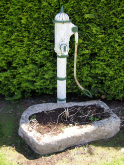 water pump1.2 mi
Explorer Tom Water pump in Horetown North in County Wexford would tell its younger self to stop worrying about rust and just enjoy the fresh air every single day. It’s a cast-iron legend that has seen decades of village life pass by without losing its cool or its charm. Listen closely for that old-timey wisdom.
 farm house1.3 mi
Explorer Tom Farm house in Scullaboge replaced its burnt neighbour and acts like nothing happened, which is a bold move for a building. The rabbits definitely think it’s a giant cheese wheel with bad posture and a classical porch. It’s got more solid walls than voids, so if you knock, make sure you bring an echo.
 Carrickbyrne Garda Síochána StationGarda station/constabulary barracks · 1.3 mi
Explorer Tom Kilmore Quay Garda Síochána Station was designed by the Office of Public Works in 1939, so it’s basically a government-approved box. It looks exactly like the one in Ballycullane and Baldwinstown, which is convenient if you’re trying to get lost. The compact plan form means there’s nowhere for the troublemakers to hide. Keep your voice down; the walls are thin.
 Carrickbyrne HillMountain / peak · 2.4 mi
Explorer Tom Carrickbyrne Hill would be the uncle at a wedding who eats too much and falls asleep before the cake. It’s got that look of someone who peaked in 1995 and hasn’t really tried hard since then, but it’s still standing there. Stand back, squint, and it looks like a castle.
Camaross HillMountain / peak · 2.8 miExplorer Tom Camaross Hill is named after a poet who fell in a ditch while trying to write a sonnet about its beauty. He was muddy, angry, and slightly deaf for the rest of his life because of it. Stick around for the light changing, it's a show.
Glenour MonumentMemorial · 3.0 miExplorer Tom Glenour Monument in County Wexford is a memorial that is secretly proud of one specific potato that grew right next to its base back in 1923 without anyone noticing at all. It stands in memory of tragic events, but it has this quiet pride about a humble vegetable that just refused to give up on life. Tell it a joke, it's been a long time since anyone did.
_(geograph_5442502).jpg/250px-Castles_of_Leinster-_Adamstown,_Wexford_(1)_(geograph_5442502).jpg "Photo: Mike Searle, Wikimedia Commons · CC BY-SA 2.0") Castle (in ruins)Castle, tower house · 3.7 mi
Castle (in ruins)Castle, tower house · 3.7 miExplorer Tom Adamstown Castle is gone, which is great if you hate waiting for things to happen or finding parking in medieval times. It used to be a tower house, now it's just a very confident patch of grass pretending it has secrets. Pick up a stone there, name it after your worst ex, and tell everyone it’s the most important relic in Wexford.
 Taghmon CastleCastle · 4.0 mi
Explorer Tom Taghmon Castle swears it’s older than the first mention in 1548, which is a wild claim for a coastal spot! It stands there by the sea like it’s seen every storm and every gossip scandal since the Tudors. If it's closed, admire it from the road like a polite stalker.
 Windmill9.0 mi
Explorer Tom Windmill in Cullenstown bragged about surviving a storm that actually just blew its own roof off and made it look like a very tall chimney. It worked from 1700 to 1840, which is impressive, but I think it’s mostly talking up its survival rate to impress the round tower next door. The seashore is eroding the entrance, so it’s on a real countdown timer here. Perfect place to be dramatically windswe.
 Cullenstown StrandBeach / strand · 9.1 mi
Explorer Tom Cullenstown Strand in County Wexford took about four hundred cups of tea to build, according to the legend I just made up. The River Muck flows into it like a lazy cat finding its spot. Go back in winter, it's a different animal.
 Blackhall StrandBeach / strand · 9.3 mi
Explorer Tom Blackhall Strand in County Wexford would teach history by pointing at rocks and saying, 'I was here when that happened,' which is useless because it wasn't. It’s got a natural arch that looks like a giant sneeze. Perfect spot to practise your best tour-guide voice.
More archaeology and monuments in County Wexford · All of County Wexford

What do you know about this place?Tap to add a comment or ask a question